


BOZEMAN – A mild SW flow aloft will continue through the weekend and early next week. This should lock us into a slightly warmer than normal temperature pattern.
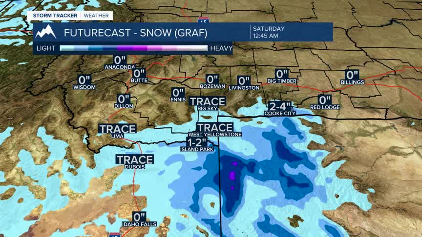
There is a Pacific storm moving slowly into Northern California Wednesday afternoon and lifting to the NE. This system has a good chance for producing areas of snow across Eastern Idaho and possibly up into the West Yellowstone region tonight through Thursday morning.
The National Weather Service issued a Winter Weather Advisory for the Island Park, ID area through 5 pm Thursday. US 20 could see several inches of snow and higher elevations could see 4”-10” with the brunt of the heavier snow across the southern end of Yellowstone National Park.
The next system will arrive in NW Montana Saturday,and this system looks weak with a better chance for mountain snow throughout western Montana.
A stronger cold front will arrive on Tuesday of next week and kick off a cooling trend along with producing valley and mountain snow.
