


BOZEMAN – A powerful spring storm system is set to impact the Pacific Northwest and Montana from Wednesday through Friday, bringing heavy mountain snow, extreme winds, and dangerous travel conditions.
Atmospheric River Brings Big Snow
An Atmospheric River will stream moisture into western Montana, delivering 2–6 inches of wet snow at lower elevations and 20–40 inches in the high country above 5,000 feet.
- Winter Storm Warning: West‑central & northwest Montana
- Timing: 6 p.m. Wednesday – Noon Saturday
- Wind Gusts: 30–60 mph
- Heaviest Snow: Bitterroot & Sapphire Mountains, West Glacier Region
Other areas at risk for heavy snow include:
- Upper Big Hole region
- Pintlar Wilderness
- Georgetown Lake area
- Absaroka–Beartooth region
- Yellowstone National Park
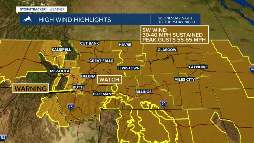
Dangerous Winds Across the State
The storm also brings damaging winds:
High Wind Warning: Southwest Montana
- Timing: Midnight Wednesday – Midnight Thursday
- Speeds: Sustained 35–45 mph, gusts 60–80 mph
- Impacts: Property damage, power outages likely
- High Wind Watch: Eastern Montana Thursday
Expected to upgrade to a warning
Safety Reminders
- Secure outdoor items before winds arrive
- Prepare for possible outages
- Avoid mountain travel during periods of heavy snow and wind
- Monitor updates from the National Weather Service
