BOZEMAN – Numerous reports of 4” to 8” of snow around SW Montana mostly east of the divide Sunday night into Monday morning impacting road conditions.
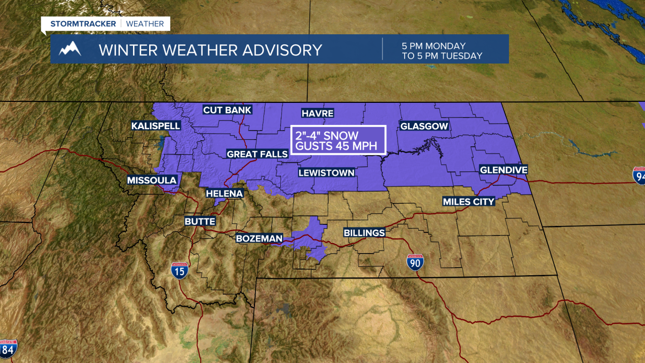
Another shot of snow will impact northern and central Montana Monday night into Tuesday night with little to no snow for SW Montana except for some mountain snow showers.
The biggest hazard for travel will come with melting during the day and refreezing at night. Another travel hazard will be localized areas of gusty wind producing some blowing and drifting snow.
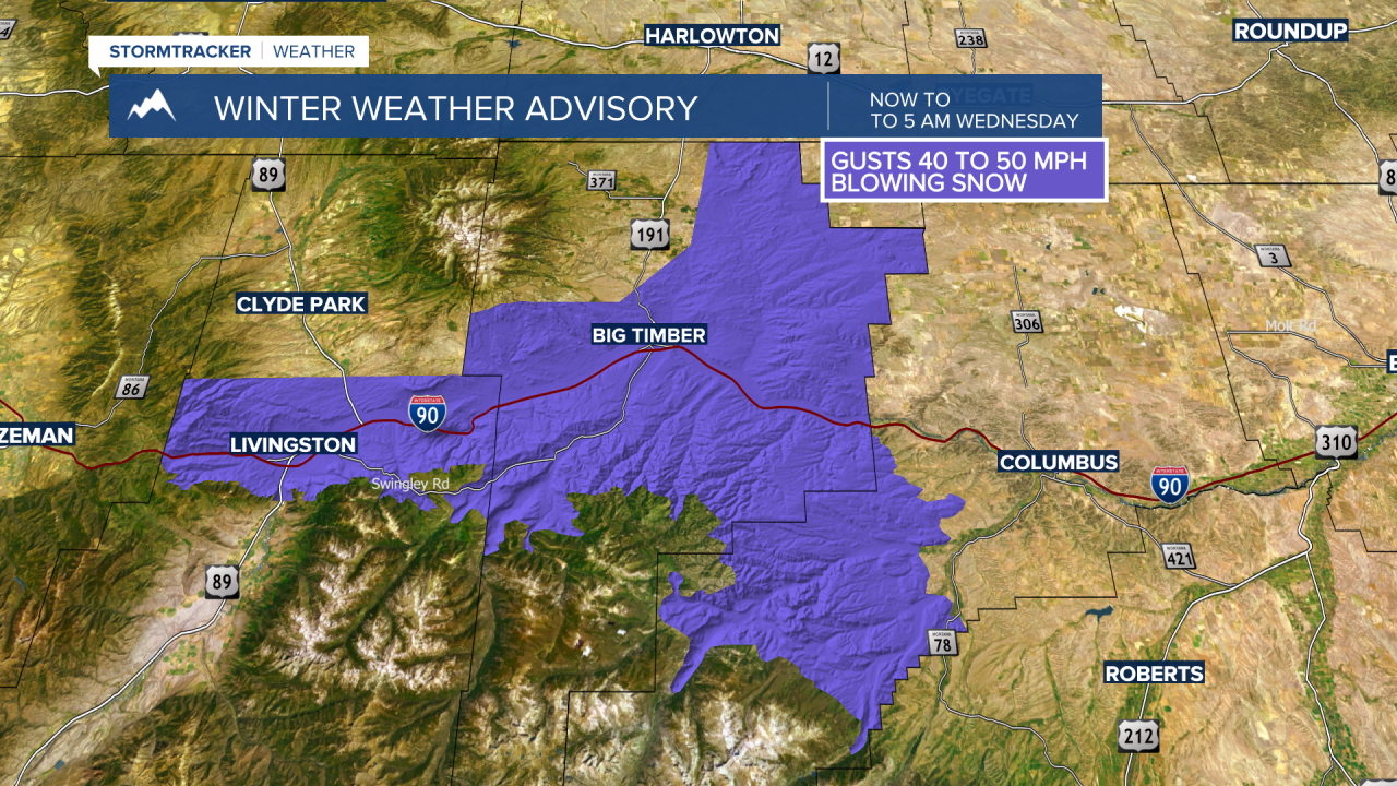
In fact, the National Weather Service has issued a WINTER WEATHER ADVISORY for the Livingston to Big Timber area now through Wednesday morning with surface wind gusts of 40 to 50 mph producing areas of blowing and drifting snow with reduced visibility.
WINTER WEATHER ADVISORIES are also up for central and northern Montana Monday night through Tuesday night with 2”-4” new snow possible along with wind gusts 30 to 50 mph and blowing snow.