


Today's Forecast:
Southwest Montana will see warm late-summer conditions today with a mix of sunshine and scattered afternoon clouds across the region. Most lower elevations stay dry, although isolated mountain thunderstorms remain possible later this afternoon and evening, especially near Yellowstone and the surrounding ranges. Wildfire smoke and haze continue to impact air quality at times, particularly during the morning and overnight hours in valley locations. Afternoon west to northwest winds will increase between 10 and 20 mph, creating elevated fire weather concerns in open areas.

BOZEMAN: High: 82; Low: 56. Mostly sunny skies today with warm afternoon temperatures and dry conditions expected through most of the day. Northwest winds increase to around 10 to 15 mph this afternoon. Areas of smoke and haze may reduce visibility and air quality at times, especially this morning and again tonight. Mostly clear skies continue overnight.
BUTTE: High: 81; Low: 50. Sunny to partly sunny skies with dry weather expected through the afternoon and evening. Northwest winds increase between 10 and 20 mph during the afternoon hours with occasional higher gusts possible. Lingering wildfire smoke may continue to impact visibility and air quality at times. Mostly clear and cool overnight.
DILLON: High: 84; Low: 54. Mostly sunny and warm today with dry conditions continuing across southwest Montana. West to northwest winds increase between 10 and 20 mph this afternoon with occasional gusts above 25 mph possible in open areas. Hazy skies remain possible due to regional wildfire smoke. Mostly clear tonight with mild overnight temperatures.
WEST YELLOWSTONE: High: 77; Low: 43. Partly sunny skies with a slight chance of isolated afternoon and evening thunderstorms near the higher terrain. Southwest winds increase between 10 and 20 mph this afternoon with gusts near 25 mph possible at times. Smoke and haze may occasionally reduce visibility through the day. Cooler overnight temperatures return tonight under partly cloudy skies.
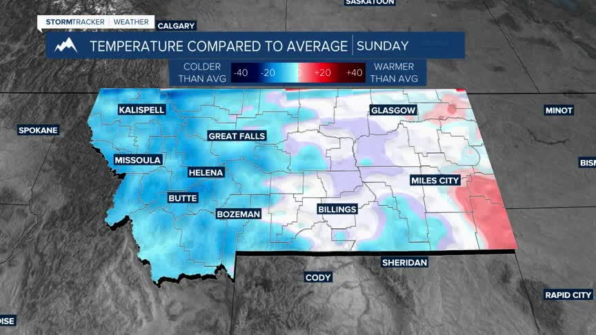
COOLER THIS WEEKEND
Southwest Montana will see a gradual increase in afternoon shower and thunderstorm chances through the second half of the week as a more unsettled weather pattern develops across the Northern Rockies. While temperatures will remain seasonably warm through Friday, widespread heat is not expected, and nearly daily isolated to scattered thunderstorms are expected during the afternoon and evening hours. A more noticeable cool-down arrives this weekend with increasing cloud cover, lower daytime temperatures and better chances for more widespread showers and thunderstorms across the region. Fire danger concerns will remain elevated at times, but improving moisture and cooler temperatures this weekend may help limit critical fire weather conditions while also providing gradual improvement to air quality in some areas.
