


BOZEMAN – A very active weather pattern will persist across Montana through the weekend.
A persistent moisture feed off the Pacific is sending a steady stream of moisture through the Pacific NW and into the Northern Rockies. Scattered rain and snow is in the forecast with the heaviest rain/snow across NW Montana.
A complicated pattern will develop Thursday afternoon through Saturday morning as shallow Arctic air drops into northern, central, and eastern Montana. This will produce rain changing to snow and a very good chance for wet roads to flash freeze. In fact, the National Weather Service has issued a WINTER STORM WATCH from Cut Bank to Billings eastward Thursday afternoon through Saturday morning.
Lewistown, for example, will see rain Thursday morning and abruptly change to snow within a few hours by early Thursday afternoon, leading to flash freezing of wet roads followed by moderate to heavy snow through Saturday.
Most of the extreme weather will bypass SW Montana. My only concern is those areas that could bump up close to the Arctic air like Bozeman to Helena for example.
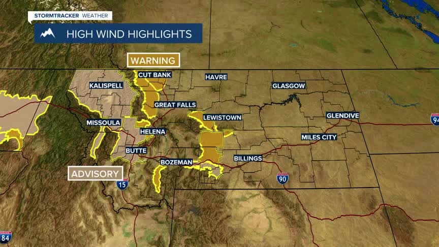
More wind is impacting SW Montana Wednesday afternoon with a Wind Advisory up for the Butte-Blackfoot region through 7 pm Wednesday for possible peak gusts up to 50+ mph.
A HIGH WIND WARNING remains in place through Thursday afternoon for the Madison River through Madison County including Ennis and Norris Hill. Sustained winds 30 to 50 mph with peak gusts up to 60+ mph are possible.
