


BOZEMAN – The weather pattern this weeks looks aggressive with strong surface wind gusts and a good chance for mountain snow.
A long fetch of warm moist air is back along the west coast and surging moisture into the Pacific NW and over into the northern Rockies for the next several days. This will bring a great chance for mountain snow to develop along the MT/ID state line and could impact travel conditions over mountain passes like Look Out Pass.
For SW Montana mountain snow is possible at times Monday night through Thursday morning with periods of heavy mountain snow possible inside Yellowstone National Park and Absaroka-Beartooth Ranges.
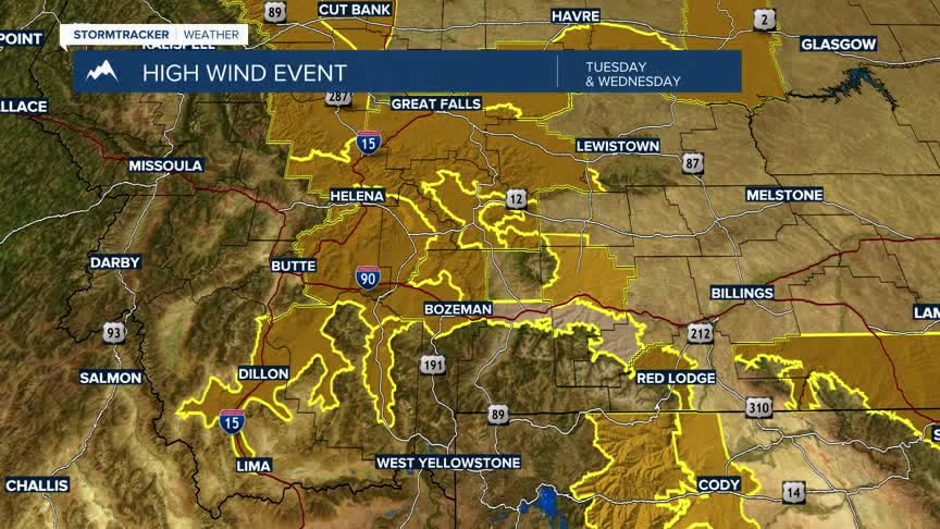
The greatest hazard for SW Montana Monday night through Thursday morning will be possible damaging wind gusts. There are a variety of High Wind Watches and Advisories up for SW Montana east of the divide. Peak wind gusts up to or over 60 mph is possible from Monida Pass to Dillon to Whitehall. US 287 from Cameron to Ennis to Three Forks. All of Jefferson and Broadwater Counties. The Northern half of Gallatin County including Bozeman, Belgrade,Manhattan on up into the Great Falls, Lewistown regions.
A High Wind Advisory is up for the Livingston area with possible gusts over 60 mph.
