BOZEMAN – Another extraordinarily complex weather pattern to playout over Montana Thursday through Saturday.
Plan now for severe winter weather with heavy snow and Arctic cold.
A NW flow aloft is paving the way for Pacific moisture to push into western Montana beginning Thursday evening. Low-pressure will develop and create areas of heavy snow Thursday night through Saturday afternoon. This alone will produce hazardous travel conditions but once the snow ends the deep Arctic air digs deeply into the valley floor.
The National Weather Service has a WINTER STORM WATCH out for most of western, central, and SW Montana Thursday night through Saturday afternoon.

This means there is a very good chance for heavy snow and areas of blowing snow. This watch will see upgrades to either winter weather advisories or winter storm warnings possibly by Thursday morning.
Confidence is high for areas of heavy snow. Snow totals will be highly varied but in general look for 3”-10” of valley snow with a foot or more at higher elevations.

This snowstorm will likely have a high-water content. The concern is that this very wet snow will flash freeze as the Arctic air moves in Saturday morning produce extremely icy road conditions. Slush covered roads could turn into horrible chunks of ice.
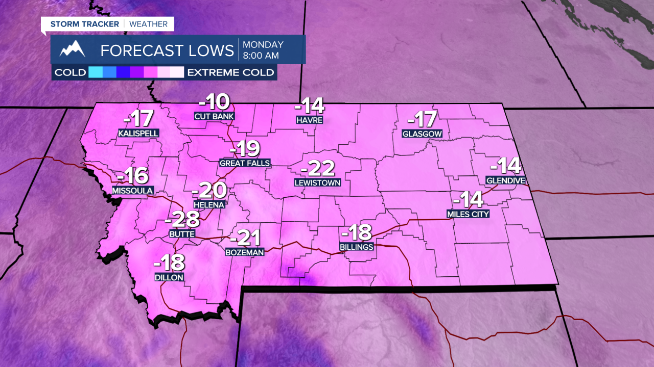
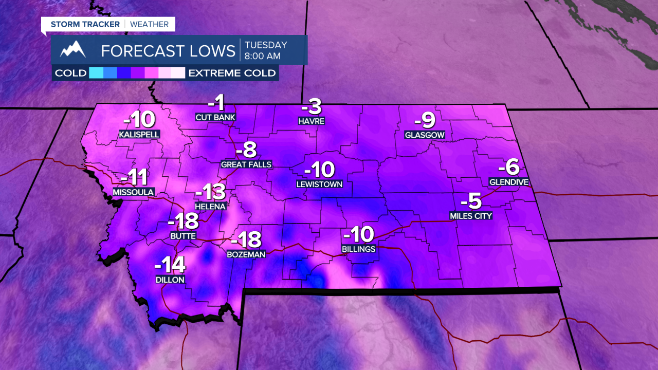
Moving onto forecast lows for SW Montana. By Sunday morning most of SW Montana will fall between –5 to –15 below zero. By Monday morning –15 to –30 below zero and by Tuesday morning –15 to –25 below zero. Wind chill values could be colder than –30 below zero.