


BOZEMAN – Another round of moderate to heavy rain will impact western and SW Montana this weekend into early next week.
The first round of moderate to heavy will push into western Montana between Butte-Missoula-Kalispell and into central Idaho Saturday morning. As the moisture is forced to lift over the mountains it could produce several inches of rainfall and that will lead to possible flooding conditions.
The storm will continue to feed moisture into SW Montana Saturday afternoon with scattered showers and thunderstorms. Some thunderstorms could produce locally heavy rainfall. Another round of moderate to heavy rain will push into SW Montana Sunday into Monday.
Forecast models show most of SW Montana could see a half an inch to one and a half inches of rain Saturday through Monday.

Snow is also possible above 8,000’. Some higher mountains peaks could see several inches of snow early next week and higher elevated valleys like West Yellowstone could see a rain/snow mix at times Sunday through Tuesday.
The combination of moderate to heavy rainfall, temperatures reaching the 70s and 80s Friday into Saturday will produce rapid runoff with snowmelt and rainfall. For this reason, the National Weather Service has issued several FLOOD WATCHES in our region.
The National Weather Service has issued a FLOOD WATCH for far Western Montana Saturday evening through Monday afternoon. Flooding is likely.

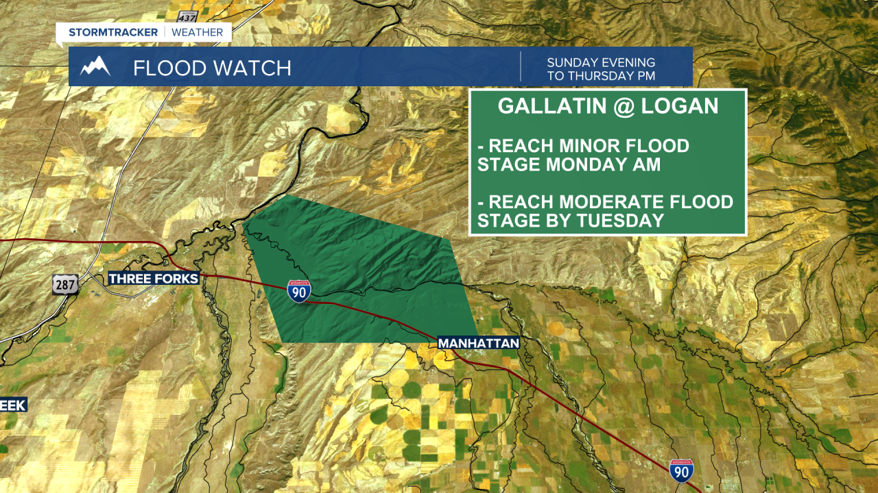
The National Weather Service has issued a FLOOD WATCH for the Gallatin River at Logan Sunday evening through Thursday afternoon. River levels are forecasted to reach Minor Flood Stage by Monday morning and Moderate Flood Stage by Tuesday.
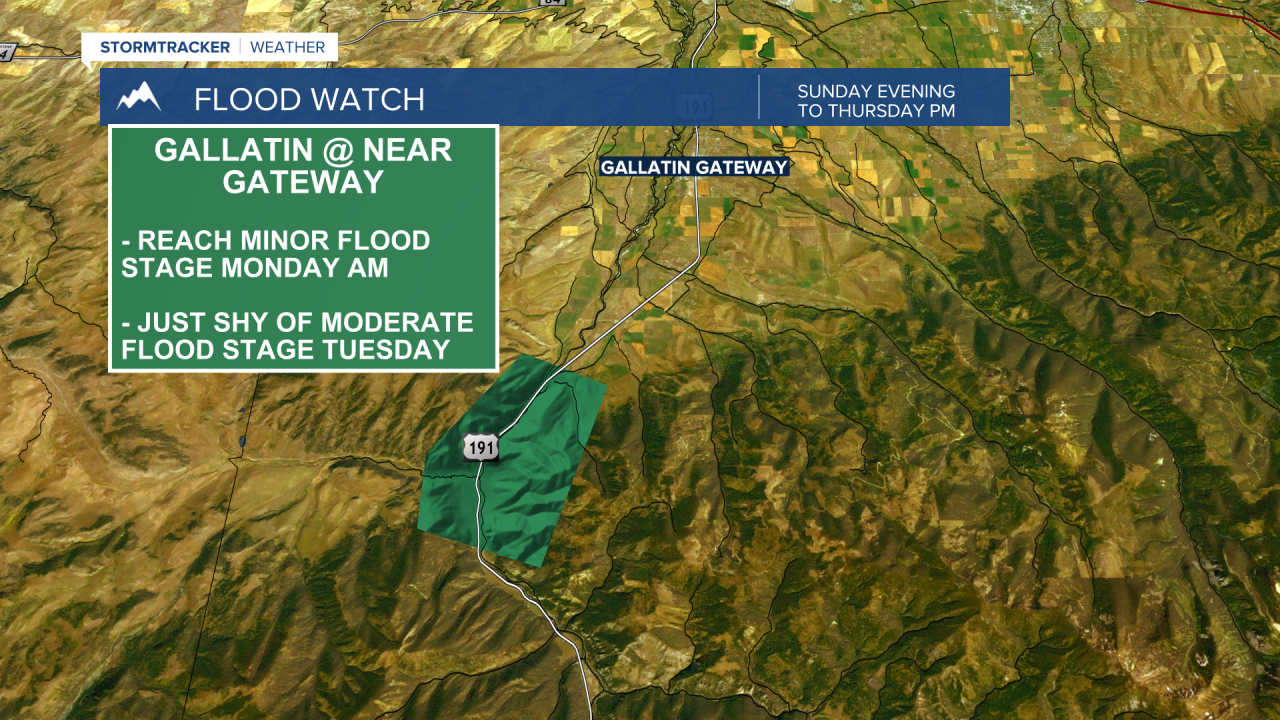
The National Weather Service has also issued a FLOOD WATCH for the Gallatin River downstream from Big Sky to the Gallatin Gateway area from Sunday evening through Thursday afternoon. River levels are forecasted to reach Minor Flood Stage by Monday morning and could come very close to Moderate Flood Stage by Tuesday.
There are no other flood highlights at this time across SW Montana, however, river levels on the Big Hole River near Melrose could reach Minor Flood Stage Monday into Tuesday. The Jefferson River at Three Forks could come very close to Minor Flood Stage early next week.
