BOZEMAN – Temperatures are above normal Tuesday afternoon and a nice thaw is occurring but this will be very brief as the next weather maker is building over Northern California.
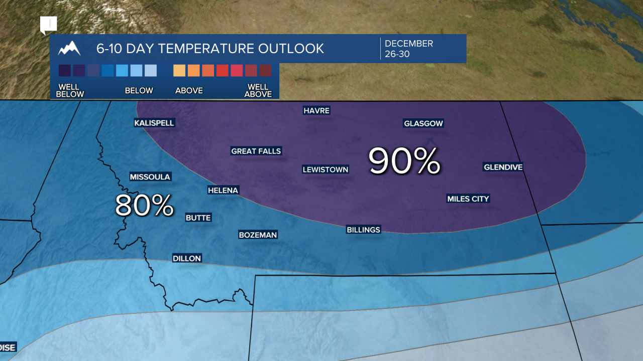
The next 10 to 15 days will be very different than today. The Climate Prediction Center’s 6 to 10 day outlook for temperature and precipitation shows some harsh winter weather is headed for Montana.
First, there is a 50% or greater chance for above normal precipitation or snow. This will likely produce difficult to hazardous travel conditions through the Christmas weekend into the New Year's weekend.

Second, there is a greater than 70% chance for well below normal temperatures. Yes this means Arctic air is coming soon. Plan now for much colder temperatures and possibly below zero lows and even colder wind chills next week.
This pattern change begins Thursday into Friday as a Pacific storm passes through the western U.S. producing increasing snow and wind across the entire region. Once this storm passes through look for a much colder NW flow to develop pulling down cold Arctic air this weekend.
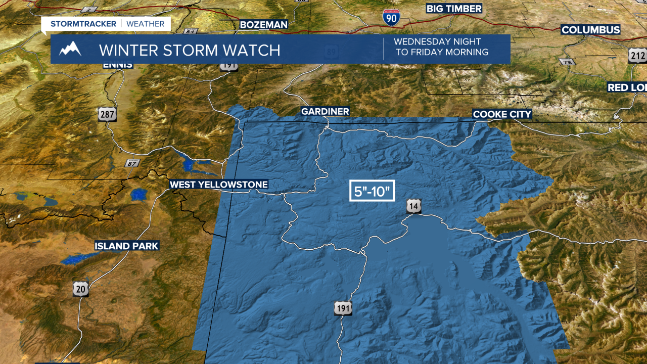
Short-term travel hazards will once again impact the MT/ID state line from Lost Trail Pass to Big Hole Pass to Monida Pass over to the West Yellowstone area. Yellowstone National Park and Cooke City areas will also see increasing snow, heavy at times Wednesday through Friday. Snow and wind will produce difficult to hazardous road conditions.
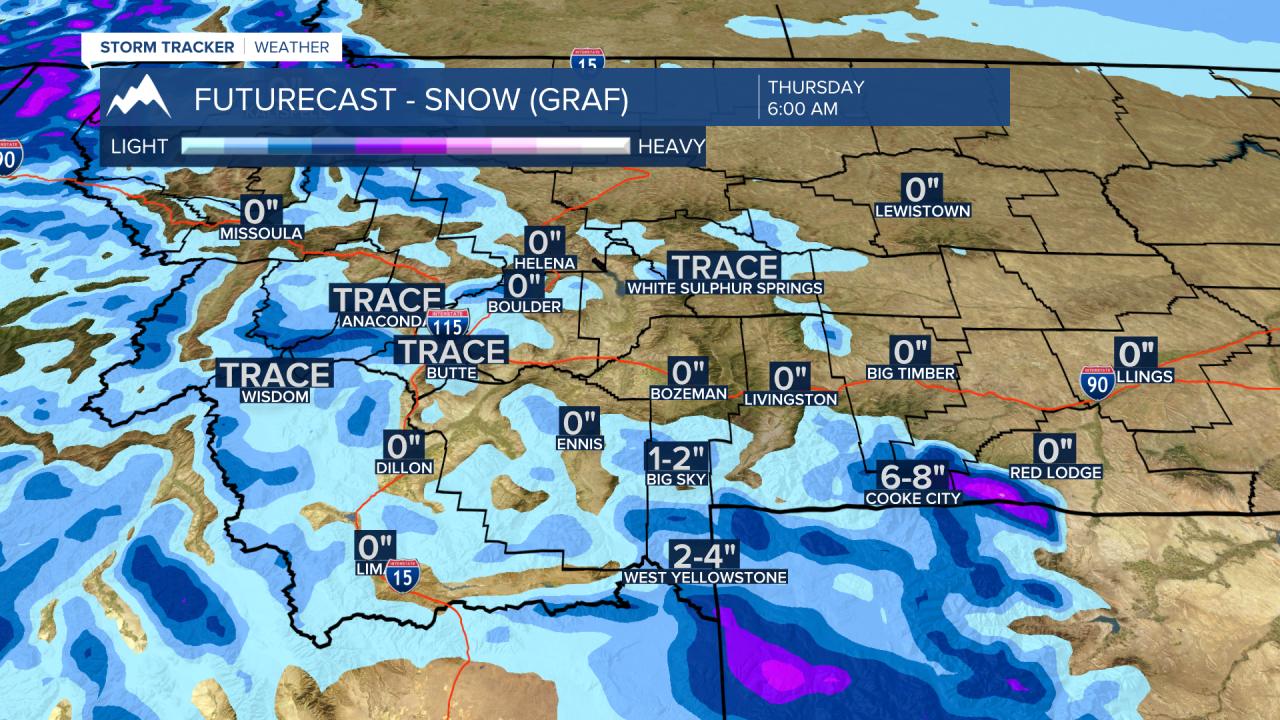
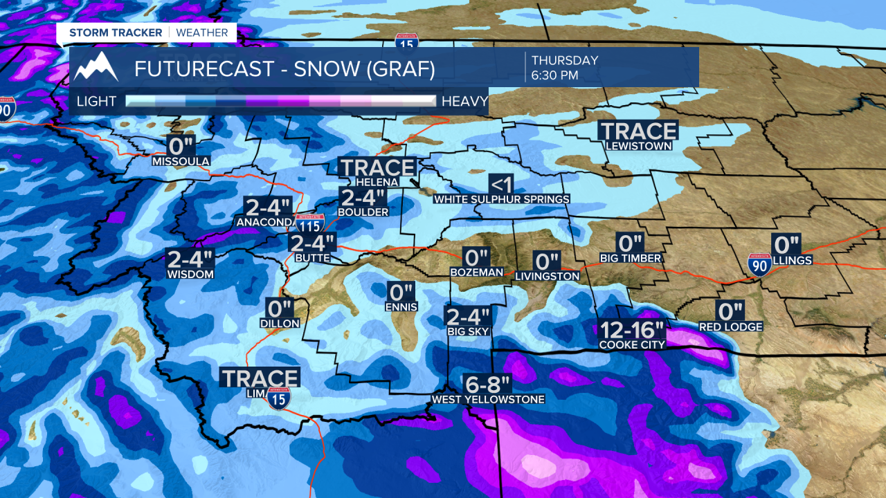
A cold front will bring a shot of snow to Butte, Anaconda, Deer Lodge areas Thursday afternoon and could impact commutes Thursday evening. This front will reach Bozeman and areas east of the divide Thursday evening and could bring difficult travel conditions by early Friday morning.
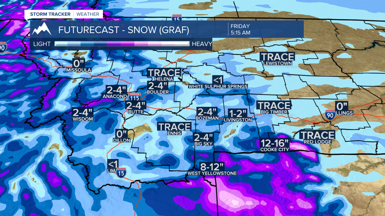
Snow will be increasing from Monida to West Yellowstone Wednesday evening and likely to continue all day Thursday through Friday morning.
Timing of possible snow accumulations for SW Montana Wednesday through Friday morning:
There will likely be some winter weather highlights issued soon from the National Weather Service regarding snow and wind across eastern Idaho and far southern Beaverhead, Madison, and Gallatin Counties. Look for updates here soon and of course on the KBZK STORMTracker weather mobile app.
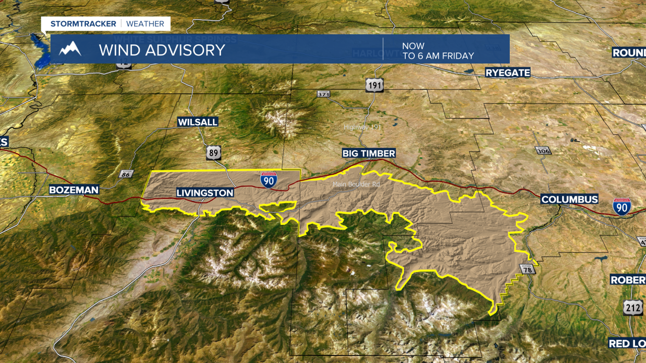
The National Weather Service issued a WIND ADVISORY for the Livingston area now through Friday morning. Look for strong surface sustained winds but damaging peak wind gusts to or over 60 mph are possible. This will create some areas of blowing snow and lower visibility but crosswind gusts on I-90 could force road closures and detours.
The National Weather Service has a WINTER STORM WATCH up for western Wyoming including Yellowstone National Park Wednesday night through Friday morning. Conditions look favorable for moderate to heavy snow with lower elevations picking up 5"-10" and above 7,000' there could be a foot or more of new snow.