


BOZEMAN – A complex weather pattern is on track for the rest of the week through most of next week. First a mild SW flow with increasing moisture will be followed by several rounds of Arctic air dropping down into Montana beginning Thursday through this weekend and into next week.
Short-term forecast is mild with slightly above average temperatures Tuesday ahead of a pacific cold front. That cold front will pass through Montana Tuesday late afternoon through Wednesday afternoon. Increasing snow and difficult wintry travel conditions are likely by Wednesday morning.
In fact, rain is possible between Whitehall and Bozeman Tuesday evening between 7 pm and midnight and change over to snow after midnight. This will produce another round of heavy wet snow like what we saw on Friday of last week. This will produce extremely icy road conditions by Wednesday morning.

The National Weather Service has a WINTER WEATHER ADVISORY up for Madison and Gallatin counties from 5 pm Tuesday through 11 pm Wednesday.
Snow accumulations: 3"-5" is likely with up to or over 7" at higher elevations. Local wind gusts 35 mph.
This includes: Bozeman pass, Raynolds pass, Targhee pass, Big Sky.
Snow and wind will produce reduced visibility and extremely icy road surfaces Wednesday.

Additional advisories could be issued for the rest of SW Montana. Stay tuned.
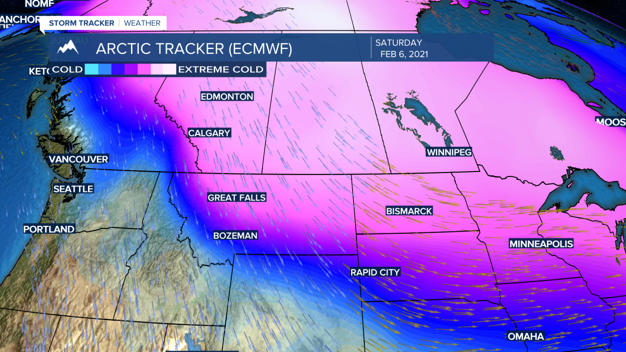
The first in a series of Arctic fronts will drop down into NE Montana on Thursday. A second and stronger surge of cold Arctic air will arrive on Saturday. Both could produce light snow, gusty winds and below zero wind chills.
Forecast models show the core of the Arctic air is likely to drop down into the Dakota’s and Great Lakes region with central and eastern Montana counties in line for some below zero air temperatures. Forecast models show a significant temperature drop for western and SW Montana as well, however, we could stay above zero. The biggest concern locally will be below zero wind chill values this weekend along with some snow.
I will have updated forecast temperatures for you in your local 7 and 10 day forecasts tonight at 5:30 pm and 10 pm on KXLF and KBZK and on the CW at 9 pm.
