


BOZEMAN – The coldest temperatures so far in December have settled over SW Montana with only lower 20s west of the divide and cold single digits east of the divide Friday afternoon.
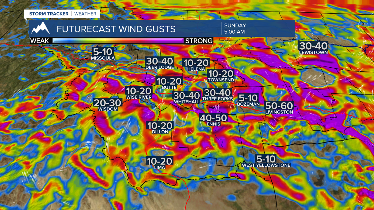
Over the weekend temperatures should rise but it comes with a windy price tag. Localized surface wind gusts Saturday through Sunday could produce blowing snow and low visibility issues.
The National Weather Service issued a WINTER WEATHER ADVISORY for the Livingston area Friday night through Sunday night. Peak wind gusts 60 to 70 mph are possible and with widespread ground snow those stronger gusts will create blowing snow and low visibility issues.

Other areas of concern for possible blowing snow will be in wind prone areas like Deer Lodge to Warm Springs, Ennis to Whitehall, Three Forks to Townsend.

The next weather maker will be a cold front moving into northern Montana Sunday and slowly digging southward Sunday evening. New snow and gusts winds will bring more wintry travel conditions from Missoula to Great Falls and sinking southward into Helena and White Sulphur Springs by Sunday night.
Plan on difficult to hazardous travel impacts north of I-90 Sunday into Monday morning for SW Montana. This includes: MacDonald Pass, Boulder Hill, Elk Park, Helena to Townsend to White Sulphur Springs. Livingston to Billings could also see periods of snow by Sunday night.

Lastly, the forecast for the Montana State University Bobcats football game should be dry. Mostly cloudy, cold, breezy by kickoff. Temperatures during the late morning or tailgating should be in the teens, by noon in the 20s and by halftime around 30 degrees. Wind will be increasing by late afternoon and gusts to 30 mph are possible for the game.

