


BOZEMAN – Unstable atmosphere over Montana again today. This time western Montana is favored for stronger thunderstorms and a few severe or damaging thunderstorms could impact central and north central Montana counties.

Thursday the severe weather threat moves into far eastern Montana. The Storm Prediction Center has a higher risk for damaging hail, damaging wind gusts, flash flooding, and possibly a tornado or two Thursday afternoon and evening near Glasgow and Glendive.

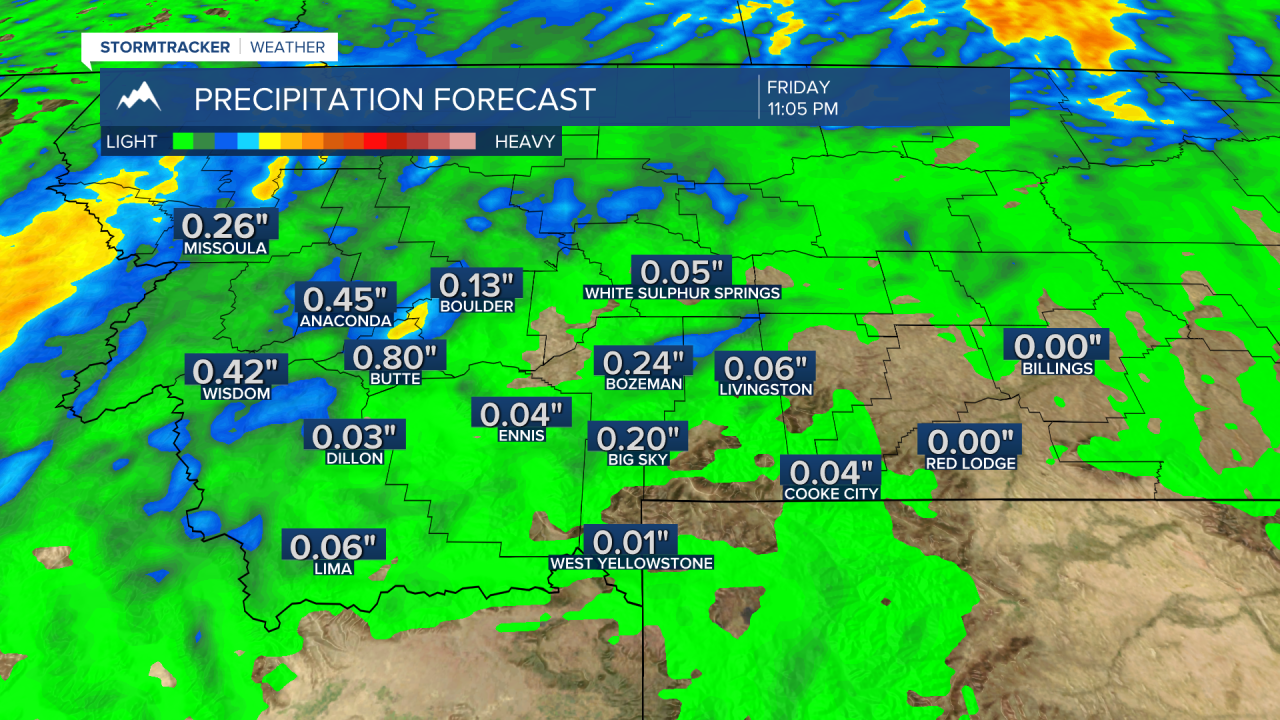
An upper-level trough will dig into Western Montana Thursday and locally this should produce scattered showers, a few thunderstorms and even some higher mountain snow. Temperatures will be much cooler Thursday with this trough passing through the state.
Some forecast models are trying to push rain totals around Butte above a half an inch of moisture Thursday and around a quarter of an inch around Bozeman.
Early next week a heat wave will return to the region with forecast highs back up in the upper 80s to mid 90s. Near record highs for SW Montana Monday and Tuesday.
