BOZEMAN – An Arctic cold front is slowly digging southward Thursday afternoon and it will continue to drop southward overnight into Friday. All of Montana will be covered in cold Arctic air by Friday afternoon.
Temperatures will be extremely cold through early next week and daytime highs along with morning lows could remain below zero.
Light wind could bring wind chills down to –30 to –50 below zero across SW Montana and possibly colder than –60 below zero along the high-line.
There is some moisture overrunning the cold Arctic air producing light to moderate and even some heavy snow through Friday afternoon. The area with the greatest potential for heavy snow will be west of the divide.
SW, Central, and Southern Montana will see light to moderate snow Thursday evening into Friday afternoon.
There are numerous Winter Weather Advisories, Winter Storm Warnings, Wind Chill Advisories, and Wind Chill Warnings covering the entire state. The wind chill advisories and warnings will continue through the weekend.
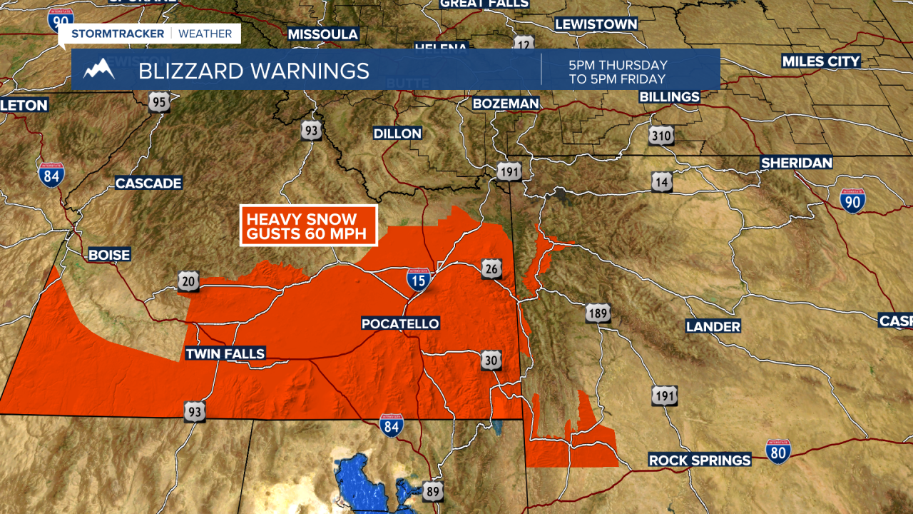
One area of great concern will be Southern Idaho into Eastern Idaho. The National Weather Service has issued a BLIZZARD WARNING Thursday afternoon through Friday evening. Heavy snow at time combined with wind gusts to 60 mph will produce whiteout travel conditions and road closures are possible.