


BOZEMAN - Severe winter weather will impact Montana this week with periods of moderate to heavy snow along with deep Arctic air.
This combination will produce hazardous to dangerous travel conditions with snow, blowing snow, extremely cold air temperatures and wind chills as low as -50 below zero.
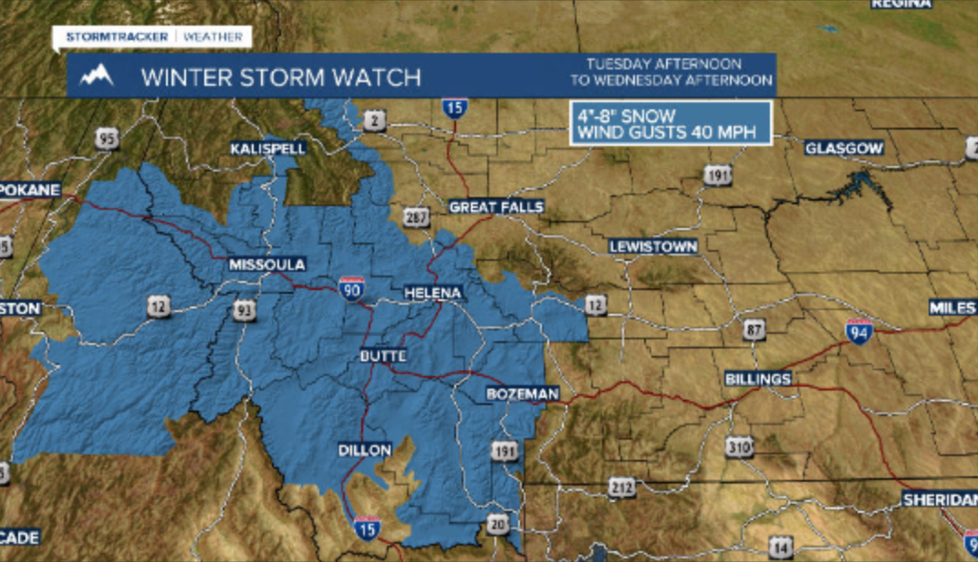
The National Weather Service has a WINTER STORM WATCH up from Tuesday afternoon through Wednesday afternoon. This means conditions look favorable for moderate to heavy snow to develop, gusts to 40 mph, blowing snow and low visibility conditions are likely.
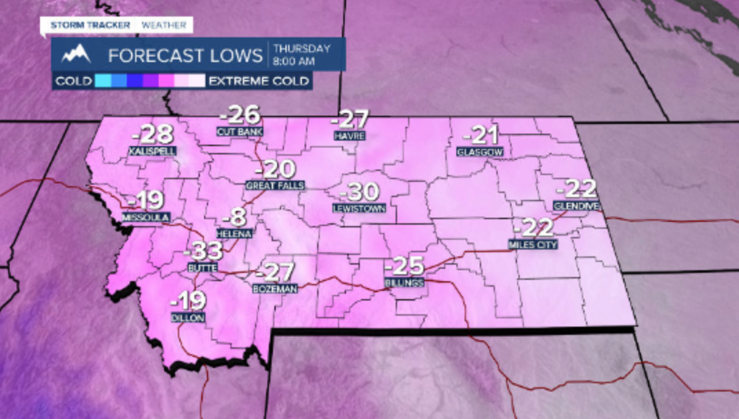
As the snow diminishes and skies clear forecast lows Thursday morning could fall -10 to -30 below zero.
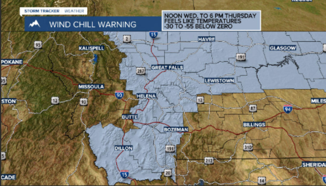
A light wind 5 to 10 mph will create feels like temperatures -30 to -50 below zero Wednesday into Thursday and for that reason the National Weather Service has a WIND CHILL WARNING up for SW Montana east of the divide.
Wind chills will also be incredibly cold west of the divide Wednesday through Friday.
Please plan ahead for bitter cold, dangerous wind chills, periods of snow and blowing snow with hazardous to dangerous travel conditions.
The forecast is still showing a rapid warming trend to begin Saturday and by Christmas Day temperatures could jump into the 30s to lower 40s.
