


BOZEMAN – Arctic High-pressure will continue to keep Montana in the deep freeze through the weekend. Forecast lows will be well below zero all weekend both east and west of the divide and wind chill or feels like temperatures will continue to be dangerously cold in the early morning hours Saturday and Sunday.
The National Weather Service has extended Wind Chill Advisory through Sunday morning for SW Montana east of the divide and a Wind Chill WARNING through 11 am Saturday for the Butte/Blackfoot region.

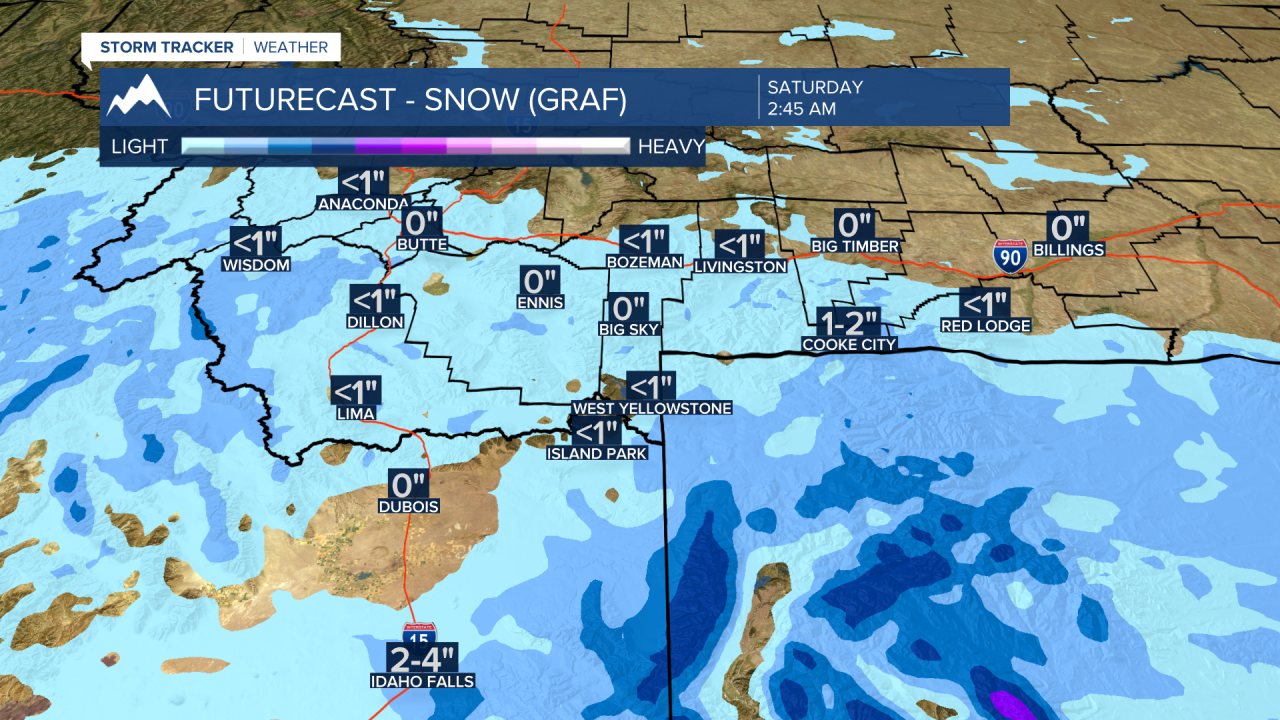
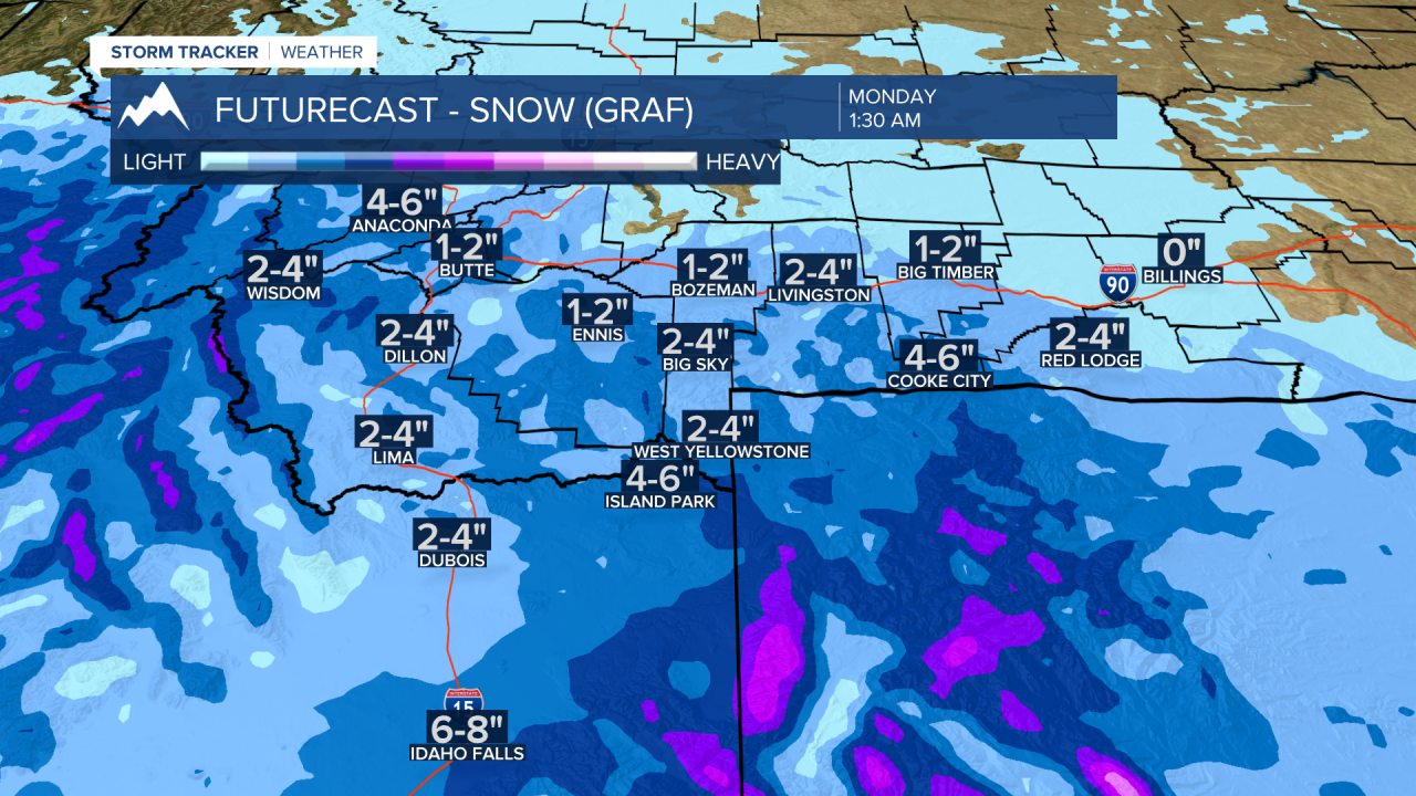
The other thing to watch out for this weekend into early next week is a parade of Pacific storms. Most of these storms will dig under Montana but some moisture will continue to clip the SW corner through early next week.
This means there will be several rounds of light powdery snow off and on this weekend through Tuesday of next week. Accumulations will be most on the light side and 1”-4” is possible for a 3 to 4 day total.
Forecast lows will remain very cold all weekend. Slightly below zero lows are possible Monday morning. Forecast models continue to predict a slow warming trend next week. I am not 100% convinced that morning lows will jump above zero by Tuesday morning. Stay tuned, for now we anticipate highs and lows to rise next week but that could change.


