


BOZEMAN – Bitter Arctic air continues to produce extreme cold across the entire state of Montana Wednesday with most reporting stations coming in with below zero temperatures.

A complex atmosphere continues to develop through the Saturday. The combination of cold dry dense Arctic air and Pacific moisture overrunning that cold air will bring snow, blowing snow, extremely cold wind chills and below zero highs and lows for most of SW Montana.
The National Weather Service has issued a WIND CHILL WARNING for the Butte/Blackfoot region from 10 pm Wednesday to noon Thursday.
Wind chill or feels like temperatures as low as -30° below zero are possible. Frostbite on exposed skin in as little as 5 minutes. Avoid outdoor activities if possible.

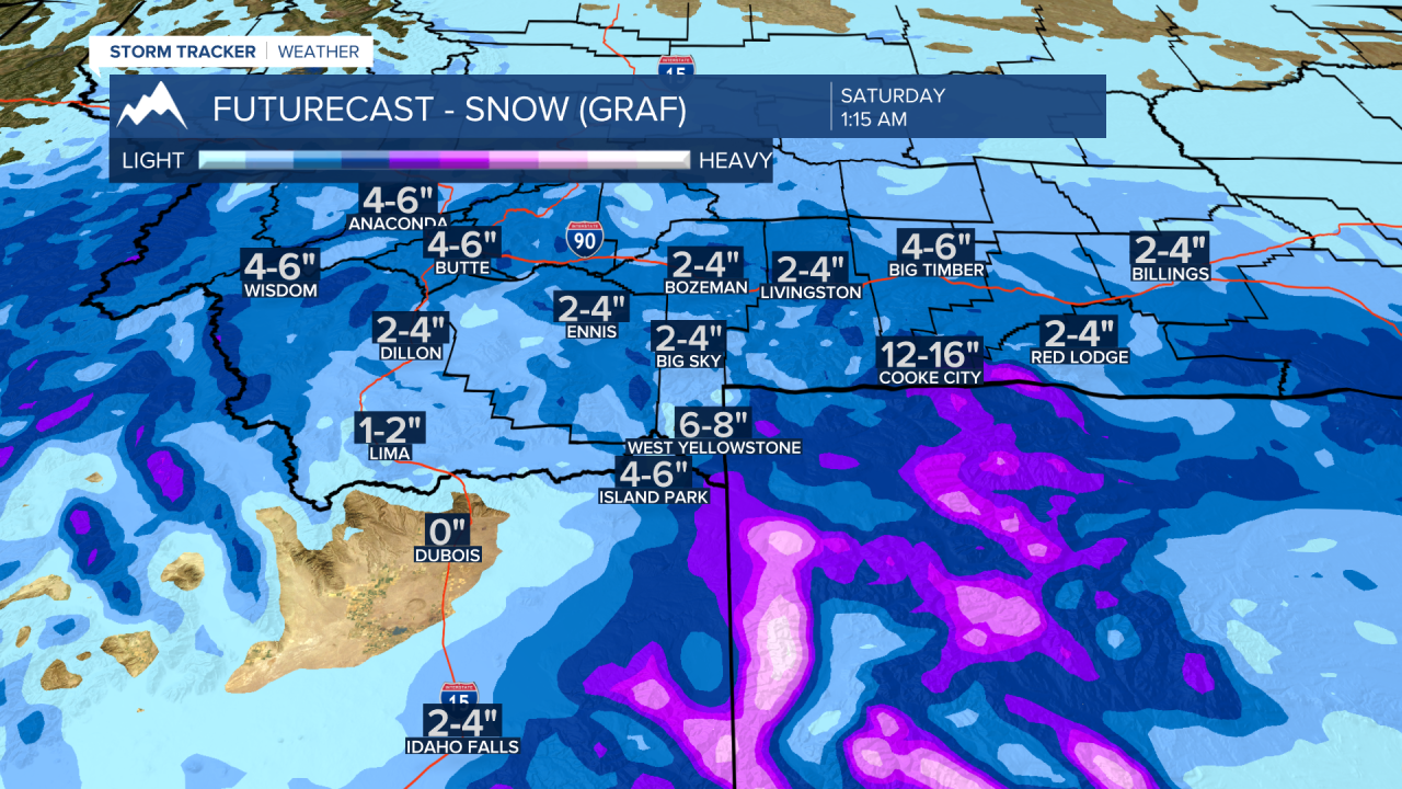
At the moment there are no watches, warnings, or advisories for snow and blowing snow for SW Montana. However, look for increasing light steady snow by Thursday afternoon along the MT/ID state line and filling in over most of SW Montana along and south of I-90 Thursday night into Friday.
General snow accumulations (likely to change) are in the 2”-4” range for most lower valleys and possibly a little more at pass level. Yellowstone National Park, Island Park, ID and from West Yellowstone to Cooke City Montana could see around 4”-8” or more of snow and higher amounts for higher mountain peaks.
Again, this should be a dry fine powdery snow that can be easily picked up and blown around reducing visibility and creating challenging driving conditions.
Forecast lows Thursday morning through Saturday morning for SW Montana will be in the -10° to -25° range and wind chills at times could be colder than -30°.


