


BOZEMAN – Low-pressure system continues to track to the NE clipping the eastern half of SW Montana Thursday. This storm system should exit out of the area by Thursday evening.
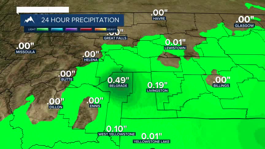
Moderate rainfall has been observed in the Bozeman/Belgrade area today with totals up to almost a half an inch at Bozeman Yellowstone Airport as of 1 pm Thursday.
Mountain snow has also been observed from West Yellowstone to Norris Hill to MacDonald Pass and up US-191 around Big Sky and of course Bozeman Pass and Bridger Canyon.
As this storm moves out, look for fog to develop overnight for those areas that did see rain and snow today. Thick fog is possible and could impact your Friday morning commute.
A weak and fast-moving disturbance could produce a quick shot of rain and snow Friday evening over SW Montana, but this system will be gone by Saturday morning.
Another shot of cold along with rain and snow is in the forecast to return Sunday afternoon through Monday morning.
