


BOZEMAN – Snow showers continue to linger over western and SW Montana this afternoon but should diminish by midnight. As skies clear overnight look for colder temperatures by early Thursday morning and cold prone higher elevation valleys could fall below zero.
The National Weather Service has extended a WINTER WEATHER ADVISORY for Madison, Gallatin, Broadwater, and Meagher counties through 11 pm Wednesday.
Snow accumulations should be on the light side with up to 1” for valleys and 1”-4” for mountain passes like Bozeman Pass. Snow should end by midnight with clearing skies by Thursday morning.

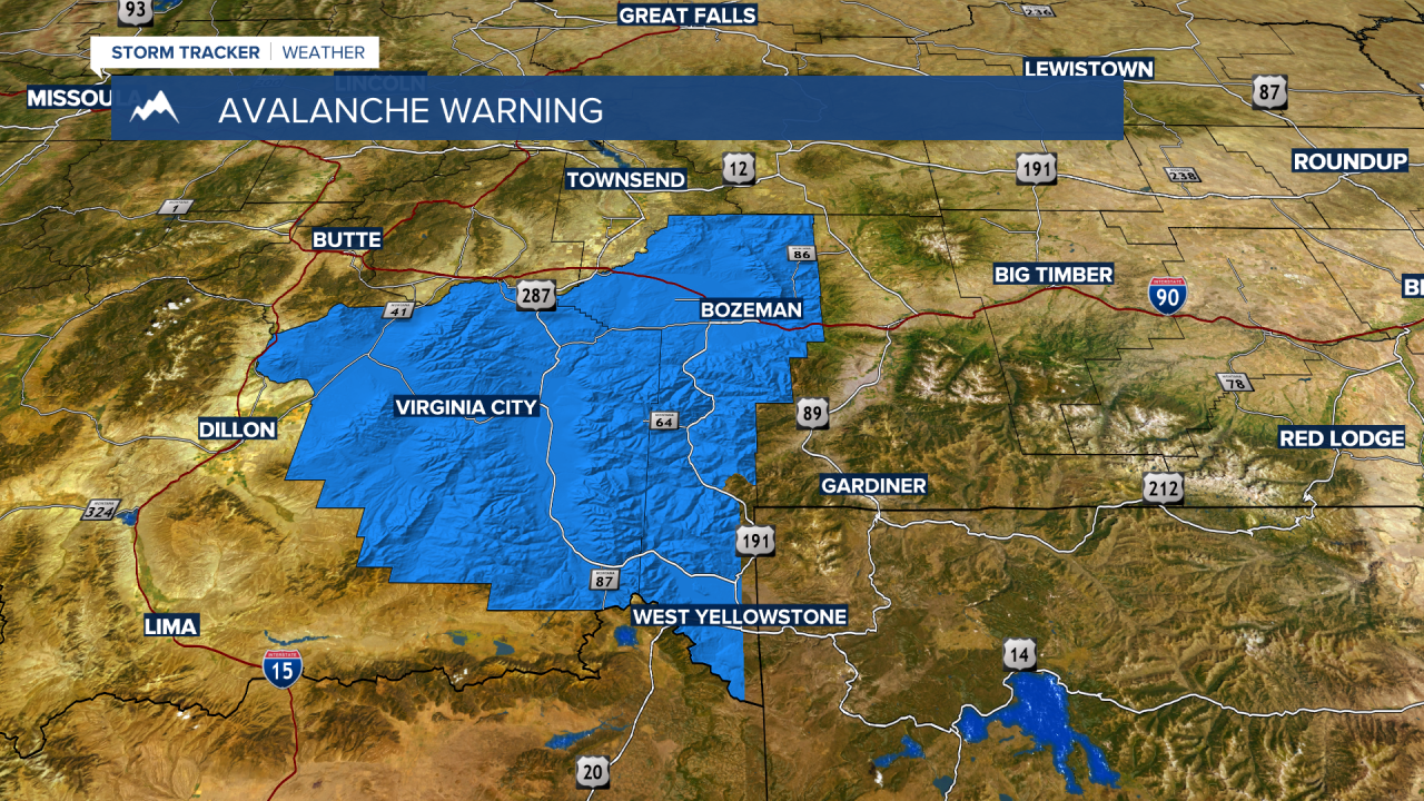
The Gallatin National Forest Avalanche Center has issued an AVALANCHE WARNING for the Bridger range, Northern Gallatin range, and Norther Madison range. Avalanche danger is rated “HIGH” on all slopes with natural and human triggered slides possible.
At least 20”-30” of snow has fallen in the last 2 days. The weight of the new snow is overloading the weak sublayers creating very dangerous avalanche conditions.

The next weather maker will be another Pacific storm to once again increase snowfall over western and SW Montana starting Thursday afternoon through Saturday morning. Mountains and passes will see periods of snow producing wintry travel conditions and at times lower valleys could see some scattered snow as well so plan on slow-go travel.

