


Today's Forecast
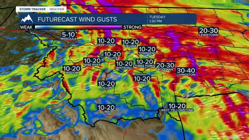
Southwest Montana will see another mild and mainly dry Tuesday. A weak disturbance passing through the region will bring some breezy conditions, but sunshine will be common through the afternoon. Winds will be the main thing you'll notice today, with gusts generally in the 20 to 25 mph range. Conditions settle down tonight as the disturbance moves east and high pressure begins building across the Northern Rockies.
BOZEMAN
High: 55; Low: 39.
Mostly sunny and breezy conditions are expected Tuesday. The strongest winds will stay farther north, but we'll still notice the breeze at times across the Gallatin Valley. Conditions quiet down tonight with temperatures falling into the lower 30s.
BUTTE
High: 53; Low: 32.
A little rain is possible early this morning, but that moves out quickly with partly cloudy skies taking over. Southwest winds increase to 20 to 30 mph at times, which will make it feel a little cooler than the thermometer suggests.
DILLON
High: 56; Low: 36.
Lots of sunshine is expected Tuesday with temperatures climbing into the middle 50s. West-southwest winds of 9 to 17 mph could gust to around 24 mph. Tonight will be partly cloudy with temperatures falling to the mid 30s.
WEST YELLOWSTONE
High: 46; Low: 27.
A little patchy fog is possible early, but it should be short-lived. Otherwise, expect mostly sunny skies with southwest winds gusting to around 23 mph. Temperatures fall into the middle 20s tonight.
COOLER AND MORE ACTIVE STARTING THIS WEEKEND
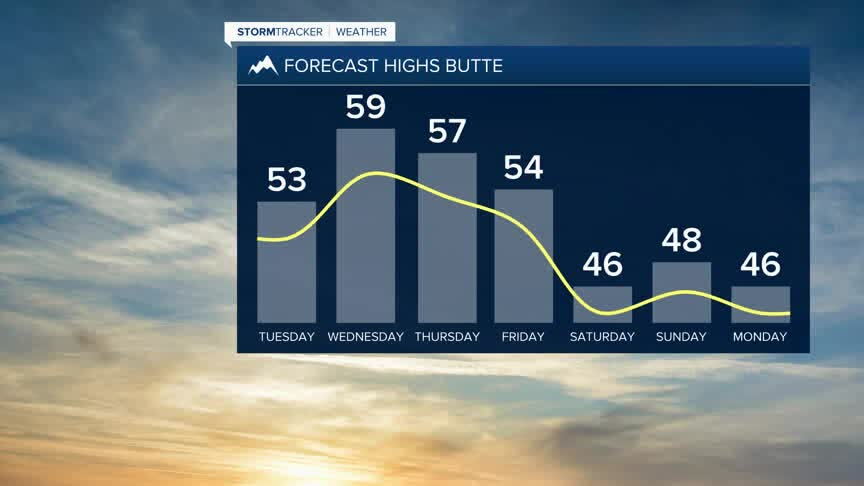
The rest of the workweek stays mild and mostly dry as a ridge of high pressure strengthens over Montana. That ridge will be at its strongest Wednesday through Friday, helping push temperatures well above average for mid-November. Many southwest Montana valleys should reach the mid 50s to lower 60s.
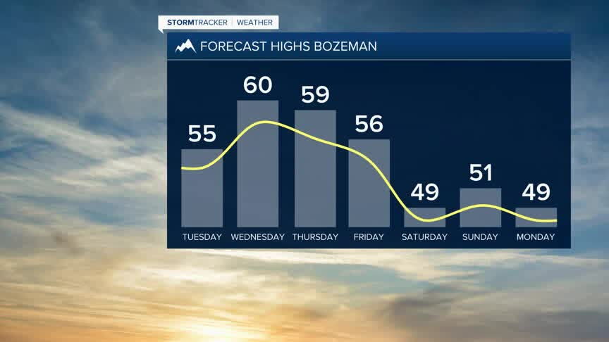
Things begin to change this weekend. An upper-level trough moving inland from the Pacific will gradually push the ridge east and bring cooler air into southwest Montana. Temperatures will come down from the warmth we see late this week, but should still remain above average for this time of year.
The more important change is what happens with moisture. As the trough moves closer, the flow aloft becomes more favorable for pulling Pacific moisture into the Northern Rockies. That means increasing chances for valley rain and mountain snow beginning this weekend.
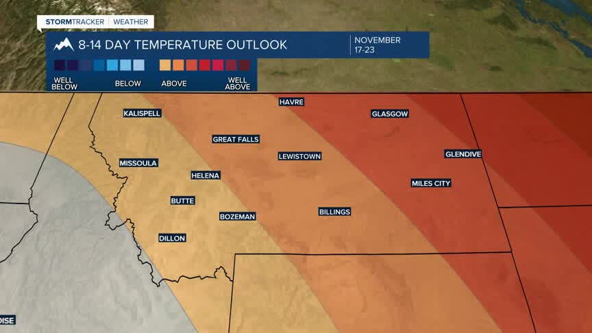
That shift appears to continue into next week, with a more active storm track developing across the region. Instead of one major storm, we may see a series of disturbances bringing repeated opportunities for valley rain and mountain snow. The overall pattern favors precipitation trending above average as we move deeper into next week.
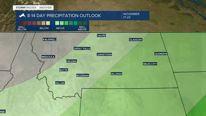
There is still uncertainty in exactly how quickly the pattern changes. About 60% of the current model guidance has the approaching trough exerting a stronger influence on our area by Sunday, so the timing of the first systems will continue to be refined.
