


Today's Forecast: Your Thursday marks the start of the changes we have been tracking since last week.Thursday will be warm enough that we could see a few thunderstorms across the area.Most of the heavy rain will be in southern Madison and Gallatin counties, though we may see a few stray showers working across the area through the afternoon.Winds will stay more southerly and could pick up to 10-20 mph at times as this next cool system works into the region for the weekend.

BOZEMAN: High: 72; Low: 54. A few spotty showers are likely for the afternoon and evening. While these storms are expected to be widely scattered, there is the possibility of a few heavier downpours during the evening.
BUTTE: High: 75; Low: 53. A few showers are possible, though the best potential is expected to be well to the south of Butte in southern Beaverhead and Madison counties.
DILLON: High: 76; Low: 57. A stray shower is possible today, but will be limited for the immediate area. Heavier rain is expected to move through overnight tonight.
WEST YELLOWSTONE: High: 67; Low: 44. Cool and cloudy for the area today as our daytime highs will not build into the 70s because of rain showers and clouds.Pockets of heavy rain and booming t-storms is likely for the late afternoon and evening.

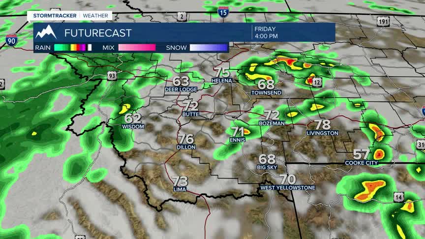
WHAT TO EXPECT HEADING INTO THE WEEKEND: There is a ton to unpack with our current forecast.This week has been near or slightly below average with temperatures so far, but the incoming Pacific system is going to drop our highs to nearly 20° below the seasonal average (low to mid 70s) starting Friday afternoon in western Montana.

The cold front is not expected to arrive until Friday night with the coldest air moving into place by Sunday morning.This system will drag plenty of moisture to the region and will bring scattered rain showers across the area through the day on Saturday through Monday.The highest mountain ranges in western and southwestern Montana will likely give us a couple inches of wet snow above 7000’.The biggest shock to our system will be the cool temperatures that will accompany the wet conditions.Temperatures are expected to bounce back to near average by Wednesday of next week.
