


BOZEMAN – A complex weather pattern will unfold over the northern U.S. this weekend into next week as Arctic air digs southward.
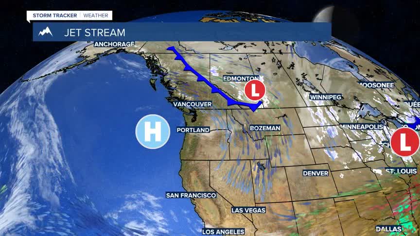
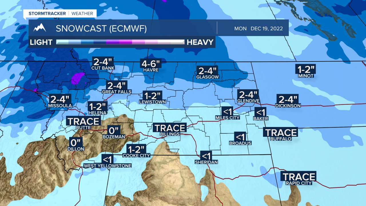
A cold front will push down into northern Montana and produce areas of snow, locally heavy over NW Montana beginning Saturday, but it is not expected to impact the southern half of the state.
Temperatures will be falling all weekend statewide with the coldest temperatures likely over the hi-line region and wind chills well below zero.
Southern Montana will see temperatures fall below normal and could even fall slightly below zero at night by Sunday.
The coldest temperatures for SW Montana should develop Sunday through Wednesday.
A large Pacific storm will begin to move into the Pacific NW Tuesday or Wednesday and eventually push into western Montana producing more snow. This storm will impact SW Montana Wednesday through Friday and possibly into the Christmas weekend.

