


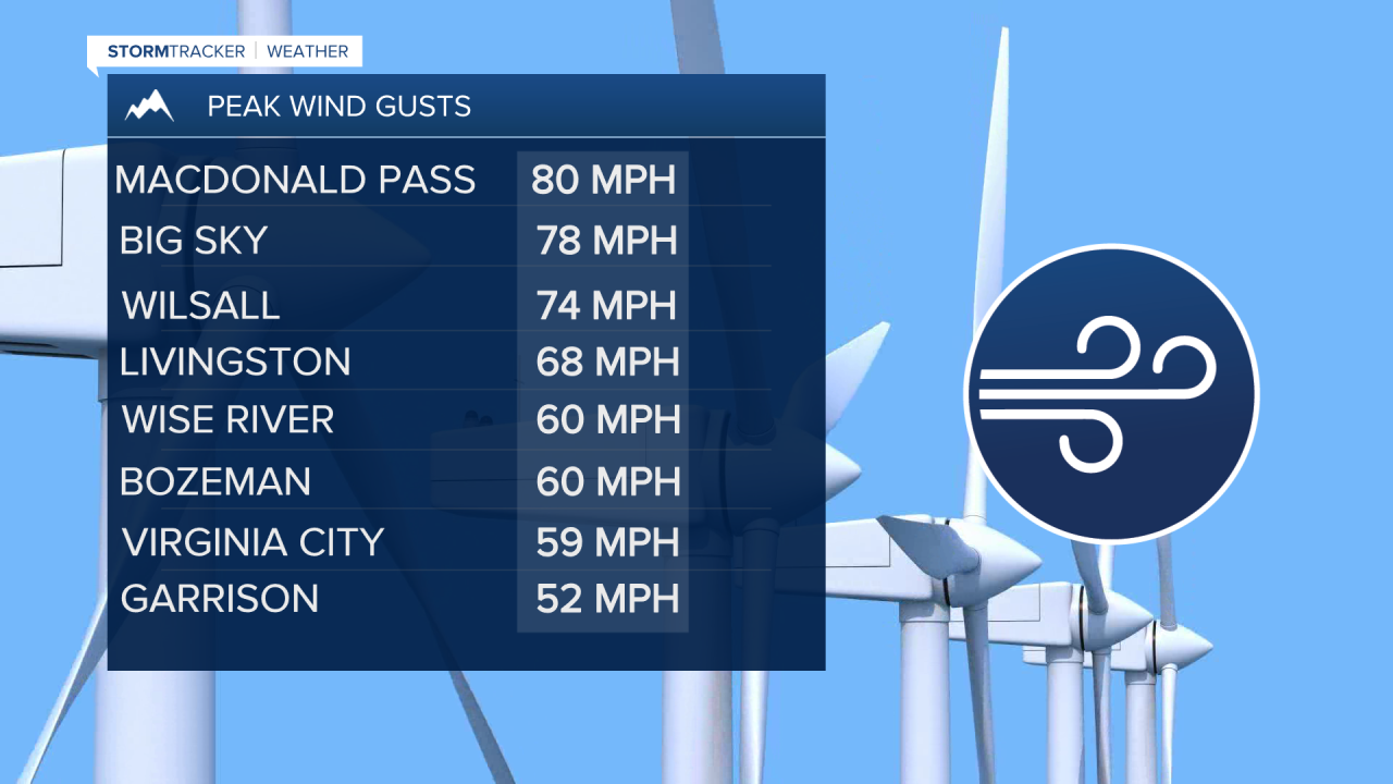
BOZEMAN – High wind event across Montana Saturday was very impressive especially for SW Montana with numerous reports of peak gusts between 50 to 80 mph.
High Wind WARNING continues through 6 pm for SW Montana. Damaging wind gusts are still possible despite a cold front that has passed through SW Montana. After sunset wind in general will gradually diminish.

The next weather pattern change is colder air moving in behind today’s cold front for Sunday but the weather pattern looks dry and hopefully improving travel conditions.
That will not last long as a blast of Arctic air begins to dig down into Montana Monday and moisture will lift up from the SW. This combination will produce widespread snow, heavy at times, along with much colder temperatures and possibly below zero lows by mid-week.

