


BOZEMAN – Widespread snow over SW Montana Friday and lower valley snow totals were mostly in the 2” to 6” range especially east of the divide.
Dillon area reporting around an inch of snow, Bozeman around 5”-6”, Belgrade 3”-5”, Churchill 3.5”, Amsterdam 6.8”, Wilsall 3.7”, and Livingston 2”-4” Friday.
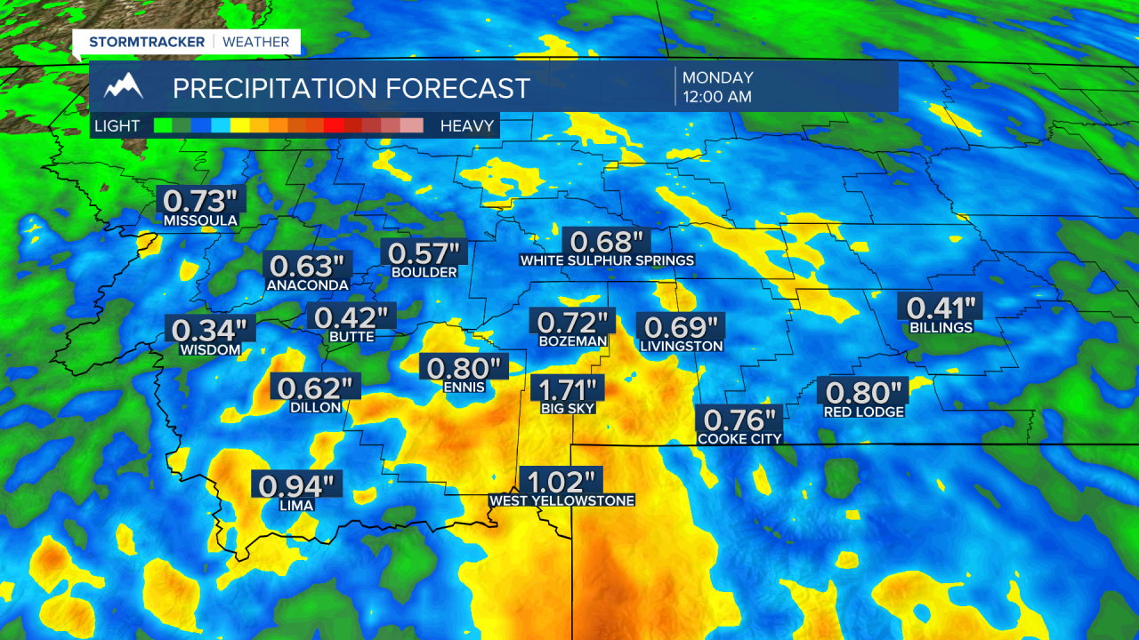
We should see a slight break in the active pattern on Saturday but another round of rain or snow is coming to most of Montana Saturday night into Sunday.
Forecast models show this should be mostly a rain event for lower valleys with heavy wet snow for most higher mountain peaks. Heaviest rain or snow should be along or south of I-90 in SW Montana.

Temperatures will be slightly warmer Saturday and the valley snow will be melting away by Saturday afternoon with highs in the upper 40s to mid 50s.
A slow warming trend should continue through next week and we could be back up into the 60s by Tuesday or Wednesday.
