


BOZEMAN – Warm and dry today for SW Montana but look for popup thunderstorms to develop Friday and continue through the holiday weekend.
Isolated late afternoon thunderstorms are likely east of the divide Friday afternoon. They should be few and far between with the best chance for weak thunderstorms over Madison and Gallatin counties.
Saturday a weak cold front will drop in from the North and ahead of the front a stronger SW flow aloft will help lift moisture up into SW Montana and produce stronger scattered thunderstorms by late afternoon into early evening Saturday.
This pattern is likely to continue into Sunday and Monday with late afternoon thunderstorms over the entire region.
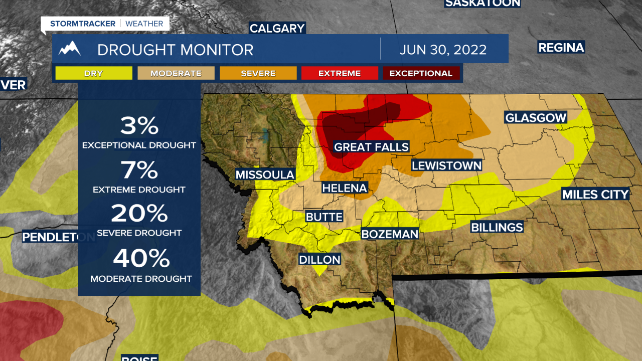
Every Thursday we get an update on the drought monitor. Over the last several weeks the drought has been improving over SW Montana and that continued this past week. Most of SW Montana is currently drought free with some abnormally dry conditions west of the divide and moderate drought conditions between Butte and Helena.
Looking at the Climate Prediction Center’s 8 to 14 day outlook heading into the first half of July the general pattern should be warmer than normal and drier than normal.


If this verifies, look for drought conditions to worsen over SW Montana heading into the hot and dry summer months of July and August.
