


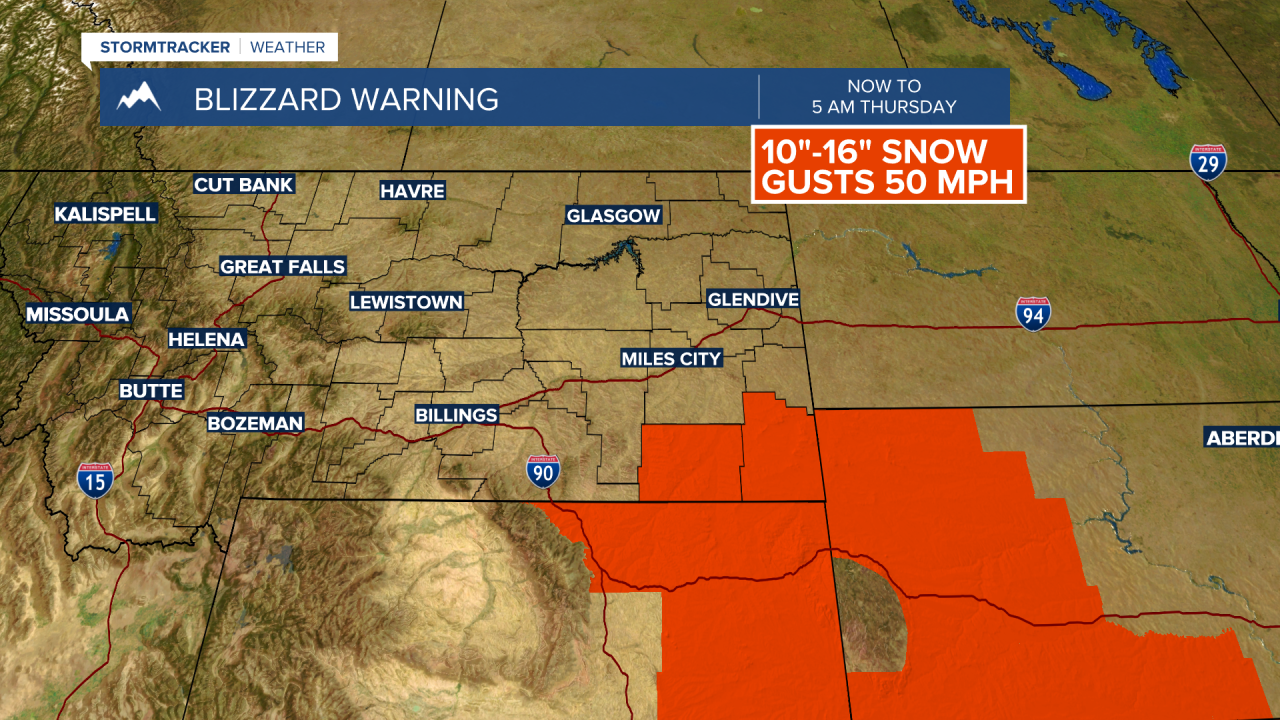
BOZEMAN – A slow moving upper-level trough is now impacting North and South Dakota, Eastern Wyoming and Eastern Montana today.
Winter Storm Warnings and Blizzard Warnings have been extended through Thursday morning for the areas mentioned above with a significant impact on travel conditions.

A weak Alberta Clipper will drop through NW Montana and pass through SW Montana Wednesday afternoon through Thursday morning producing areas of light snow and localized areas of blowing and drifting snow.
This disturbance will have a minor impact on travel conditions locally with slow-go travel conditions for your Wednesday evening and Thursday morning commutes.
This snowfall forecast model shows a significant amount of snow is likely across Eastern Montana and the Dakotas, whereas the West and SW counties of Montana will could another inch or two through Thursday afternoon.

The 6 to 10 day outlook has a slightly drier than normal pattern for far western Montana and near to slightly above normal precipitation for central and eastern Montana next week.
There is a very strong likelihood that for well below normal temperatures across the entire state this weekend through all of next week. A 90 to 100% chance of below normal temperatures. This also means there is a high probability for below zero temperatures next week across the state.


