


BOZEMAN – A strong westerly flow aloft is paving the way for Pacific moisture to stream into the Pacific NW, Idaho and through Montana for another 24 hours. Greatest snow potential will be over Look Out Pass on I-90 in far western Montana and more of the scattered light snow over the northern half of SW Montana mostly north of I-90.
The National Weather Service continues a WINTER WEATHER ADVISORY for the Butte/Blackfoot region through 5 pm Monday. Snow bands could produce areas of snow, low visibility and icy roads through this evening.

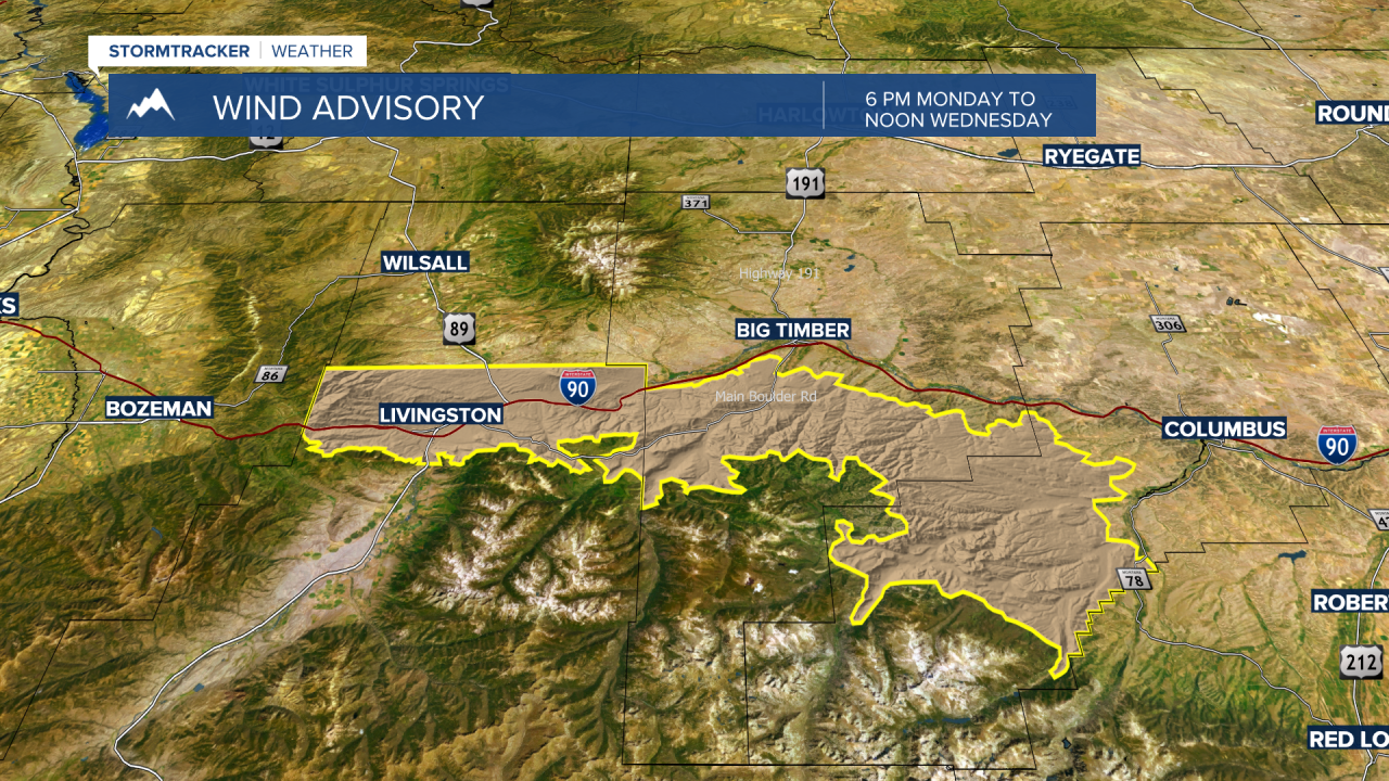
The National Weather Service has issued a WIND ADVISORY for the Livingston area beginning at 6 pm Monday through noon Wednesday. This area could see peak wind gusts at times around 65 mph and with considerable ground snow look for blowing snow and low visibility issues if traveling in this region.
Snow will once again increase in the West Yellowstone region through Yellowstone National Park up into the Cooke City area Wednesday into Thursday. In fact, snow is in the forecast for this area beginning Wednesday and continuing through the weekend. Snow accumulations could be moderate to heavy at times in the West Yellowstone area so plan accordingly if you plan on traveling to West Yellowstone through Island Park, ID.

Updated forecasts for the next 7 to 10 days will be coming up tonight at 5:30 pm and 10 pm on KXLF and KBZK.
