


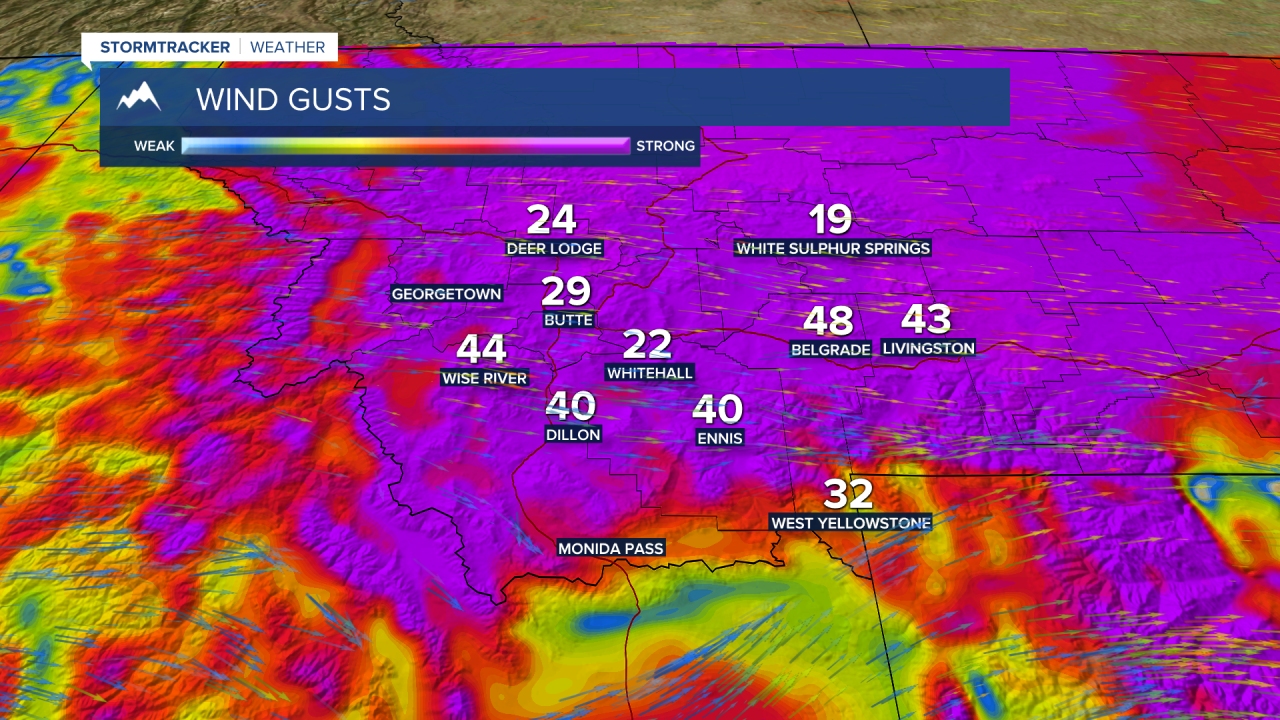
BOZEMAN – Strong gusty winds impacting most of Montana Wednesday as a strong cold front passes through the region.
There are Wind Advisories and High Wind Warnings up through Wednesday evening with peak gusts between 30 to 60 mph possible through at least sunset. Most of the stronger gusts should diminish overnight from west to east over Montana.

Up next is a milder pattern for Thursday and Friday. A short-lived High-pressure system and a SW flow with a warm front will arrive Thursday. By Friday temperatures will once again jump well above normal with numerous 60s likely and a few lucky low 70’s.
By Friday afternoon a cold front will begin to clip the NW corner of Montana producing scattered rain or snow. This front will sink to the SE by Saturday morning and kick off a cooling trend this weekend and could produce some scattered rain or snow over SW Montana early Saturday morning.
By Sunday the flow aloft will be locked into place out of the NW and this will keep temperatures trending cooler than normal for Halloween into most of next week.
