BOZEMAN – The next 2 days will bring impressive snow to most of Montana and extremely difficult to hazardous travel conditions.
The next weather maker is a warm core storm system that will collide with the cold dense Arctic air over Montana. As the warm moist air lifts over the colder surface air widespread snow will once again develop over the entire region.
A warm front will arrive by Thursday morning. This will begin to push the Arctic air out of the state with a rapid warm up by Thursday afternoon. However, this warm front will bring heavy wet snow to the region and as that accumulates on the ground, roads will become extremely icy, snowpacked, and rough.
A cold front will be the next phase of this snow event by Friday morning producing more snow, blowing snow, with difficult to impossible travel conditions.
There will be new winter storm warnings issued later today and a variety of winter weather advisories.
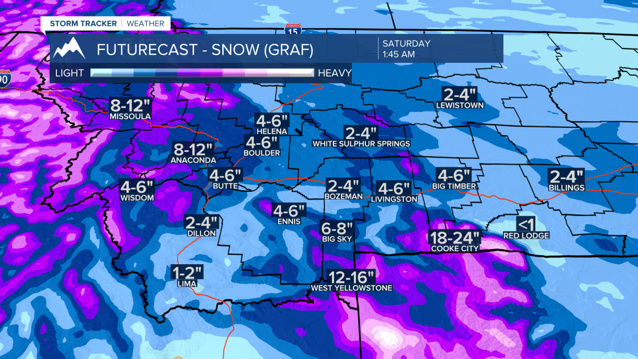
Forecast models show 3 areas that could see substantial snow. Butte/Blackfoot region, Missoula to Kalispell to Spokane, WA, and the Absaroka-Beartooth range. Mountain snow accumulations could be 1’ to 3’ feet.
Snow accumulations for SW Montana look for 1”-3” for Butte, Bozeman, Dillon, West Yellowstone and all areas in-between by 6am Thursday. Snow will continue throughout the day Thursday and snow totals will go up between 2”-6” or more. The next round of snow Friday morning could produce several inches of new snow and with off and on bands of snow Friday into Saturday morning some of you will see several more inches of snow. By Saturday morning you could see this much total snow from Wednesday through Saturday morning (see graphic below).