
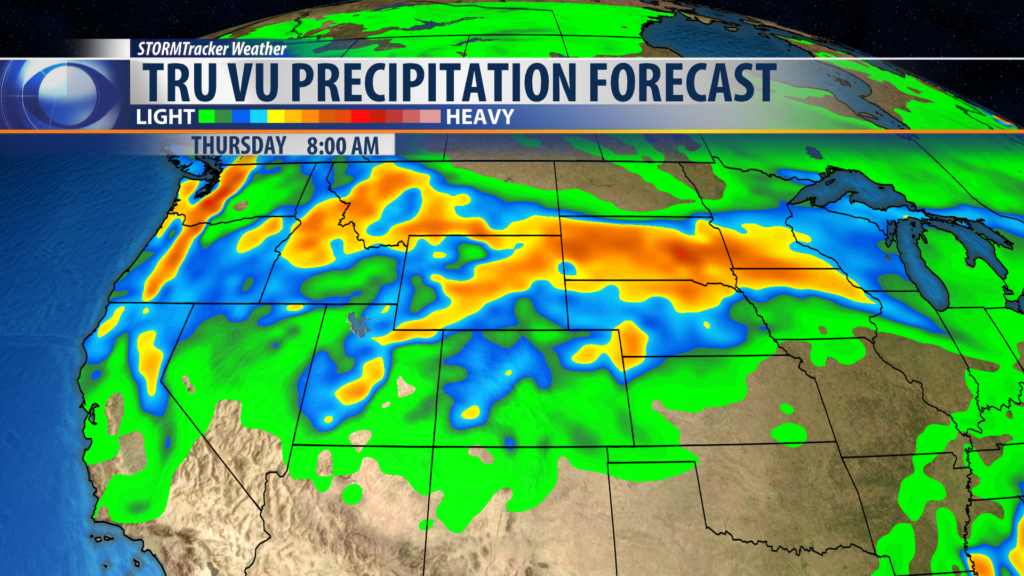
BOZEMAN – A very wet weather pattern will continue to impact Montana through Thursday. The upper-level jet stream is paving the way for deep subtropical moisture to stream up into the Pacific NW and the Northern Rockies.
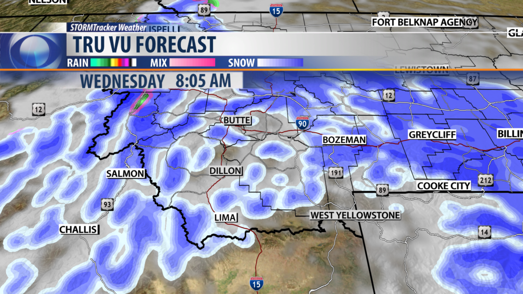
Temperatures are warm enough to produce valley rain and mountain snow but mid-week colder air will dig down into Montana and snow levels could drop down to the valley floor. Wednesday morning commutes could be a slow go venture with heavy wet snow at pass level and pockets of wet snow down in the valley floors.
Snow accumulations above 7,000′ could be heavy at times and for the Absaroka Beartooth mountains near Cooke City 1′ to 2′ of heavy wet snow is possible over the next 3 days. This will likely increase avalanche danger.
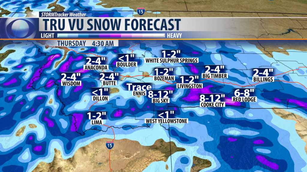
Over the next 3 days most valley locations could pick up a quarter of an inch up to 2″ of wet weather. This could lead to runoff issue and with a saturated valley floor ponding and minor low land flooding is possible.
City by City Forecast:
BOZEMAN: LOW: 34°; HIGH TUESDAY: 42°. Mostly valley rain tonight but it could mix with snow by Tuesday morning. Snow levels Tuesday should be around 7,000′ with 2″ – 5″ possible. Tuesday night into Wednesday snow levels could fall down to the valley floor with several inches possible but heavy wet snow is likely for nearby mountain ranges Tuesday night through Thursday morning.
BUTTE: LOW: 30°; HIGH TUESDAY: 42°. A rain/snow mix is likely tonight into Tuesday. Snow levels will fall down to around 5,000′ Tuesday night into Wednesday and snow accumulations for Butte around 1″ – 4″ is possible by Wednesday night. NW winds will be increasing 15 to 25 mph.
DILLON: LOW: 34°; HIGH TUESDAY: 43°. Rain will continue for Dillon tonight through Thursday morning. Snow levels around 6,500′ tonight into Tuesday but could drop down to the valley floor by Wednesday morning. NW winds could gust over 30 mph at times.
WEST YELLOWSTONE: LOW: 28°; HIGH TUESDAY: 45°. Rain/snow mix is likely tonight into Tuesday but look for mostly snow Tuesday night through Thursday morning. Snow accumulations are likely for West Yellowstone around 1″ – 4″ but nearby mountain ranges including Yellowstone National Park could see over a foot of wet snow above 7,000′. NW winds will be increasing 15 to 25 mph.
