BOZEMAN – Start planning for some harsh winter weather to impact Montana and most of the region.
The two big weather impacts will be a Low-pressure system dropping in from British Columbia Friday into Saturday producing widespread areas of moderate to heavy snow at all levels. It’s still too early to project snow totals but most forecast models have us in for around 4”-8” of valley snow with higher amounts possible and mountains over a foot.
The other big weather impact will be Arctic air dropping in behind that Low-pressure system by Saturday. Temperatures will rapidly fall as the Arctic air digs in by Saturday morning. This sudden temperature drop will flash freeze wet roads and produce extremely icy road surfaces Saturday.
As the snow ends, the Arctic air digs deeply into the valley floor. Forecast morning lows could fall between –5 to –30 below zero Sunday into Monday morning. Wind chill values could be extremely cold, falling between –20 to –30 or colder.

This will be a very difficult time for new young livestock.
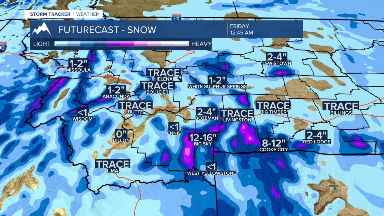
Before these two big weather events begin, we will continue to see weak disturbances move through SW Montana Wednesday through Friday morning. Look for areas of light snow periodically producing snow covered and icy roads.