


BOZEMAN – Two distinct waves of colder air are expected to drop south from Canada, and both systems will be moisture-starved and unlikely to bring significant rain or snow to SW Montana.
The first cold front, arriving Tuesday, and a second on Friday, will introduce a minor cool-down west of the divide with a more substantial cooling trend east of the divide. The coldest air temperatures will arrive with the second Arctic front on Thursday afternoon into Friday and could linger into Saturday morning. Far eastern Montana could experience below zero temperatures along with extremely cold wind chills.
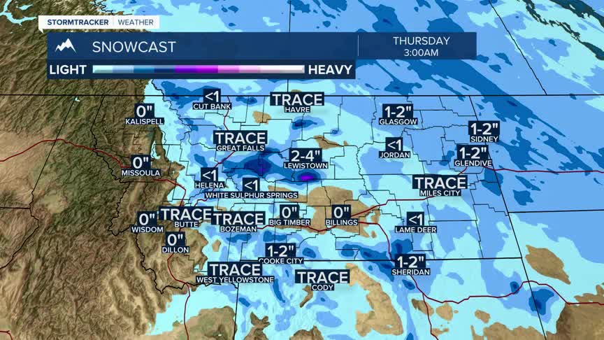
There is a slight chance for valley and mountain snow with the first cold front from Canada arriving Tuesday morning and diminishing by Tuesday evening especially east of the divide.
The dominant pattern will feature dense valley fog and low stratus clouds developing overnight and lingering into the morning hours before improving in the afternoon west of the divide.
Temperatures could quickly moderate by the end of the weekend into early next week across all areas of SW Montana.
