


BOZEMAN – Severe winter weather continues to impact Montana Sunday morning as an Arctic front is digging south at the same time Pacific moisture lingers over the region. The end result is snow, blowing snow, reduced visibility, snow covered and icy roads.
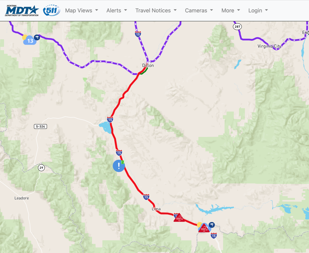
Conditions are bad enough that road closures have been reported as of 11:30 am Sunday along the MT/ID state line from Monida to Raynolds pass.
Montana Department of Transportation is reporting a full road closure from Dillon southward over Monida Pass on I-15.
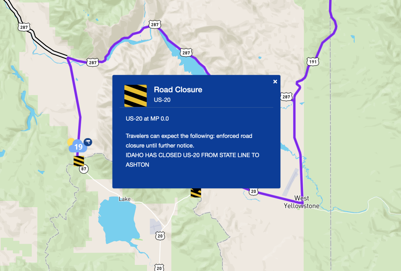
Idaho Department of Transportation has closed the Island Park area including Raynolds pass on US 20.
Butte to Bozeman to Billings continues to see light to moderate snowfall into Sunday afternoon. As the Arctic collides with the Pacific moisture this combination is producing a dry powdery snow that is conducive to blowing and reduced visibility with wind and vehicle traffic.
Wind chill values will fall to dangerous level Sunday night into Monday morning adding another layer of complication to travel conditions.
Forecast lows will begin to drop below zero by Monday morning and well below zero by Wednesday morning with early morning wind chills values colder than -20 degrees below zero possible.
