


HAMILTON - There has been slight growth at the Hog Trough Fire burning on the Bitterroot National Forest.
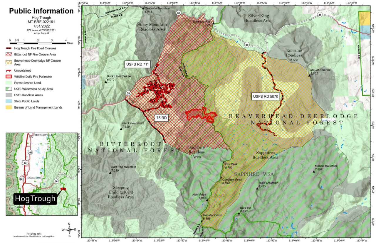
The blaze — which is 18 miles southeast of Hamilton — has grown from 635 acres to 672 acres and remains 9% contained.
Fire managers report that fire activity is expected to be moderate with creeping and smoldering on the north and west sides of the fire perimeter.
More active fire behavior is expected on Sunday afternoon and smoke may be visible.

A Red Flag Warning has been issued from 2 p.m. until 9 p.m. on Sunday by the National Weather Service Office in Missoula.
The fire was discovered on July 17 and is burning in rugged and remote terrain in an old burn fire scar from the 2000 fires.
No structures are currently threatened.
Forest Service 75 (Skalkaho-Rye) Road is currently closed from the junction of Skalkaho Highway to near the Skalkaho Creek Trailhead. Forest Service 5071 Road is closed.
There are 238 people assigned to the Hog Trough Fire which is being overseen by a Type III Incident Management Team.
Closures:
- FS Road 75, From Junction 38 and FS 75 to Mile Marker 5 (Skalkaho Creek-Jerry Lake Trailhead #503).
- FS Road 5070 Closed.
- Railroad Creek, National Forest System Trail #77 to Trail#313 at the gate.
- Weasel Creek, National Forest System Trail #156 from milepost 0.00 at its junction with NFSR #461.
- A section of the Bitterroot Rock Creek Divide Trail #313, National Forest System Trail #313 where it intersects Trail #77 Railroad Creek, Weasel Creek Trail #156.
- Skalkaho Creek -Jerry Lake Trail #503, National Forest System Trail #503.
Fire Danger is currently “very high” on the Bitterroot National Forest.
