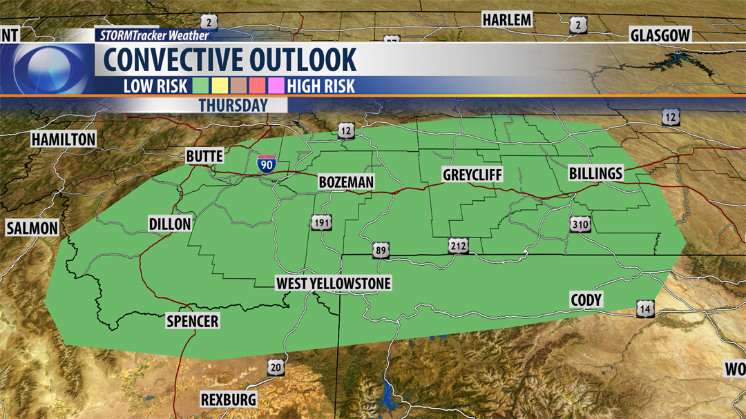
Storm Prediction Center has a "marginal" risk for a few severe thunderstorms to develop over SW Montana Thursday afternoon and evening.
Greatest concern is damaging outflow wind gusts 50 to 60 mph.
Be sure to frequently check the STORMTracker Weather Mobile app if you have outdoor plans Thursday afternoon so you can track all thunderstorms in our area.
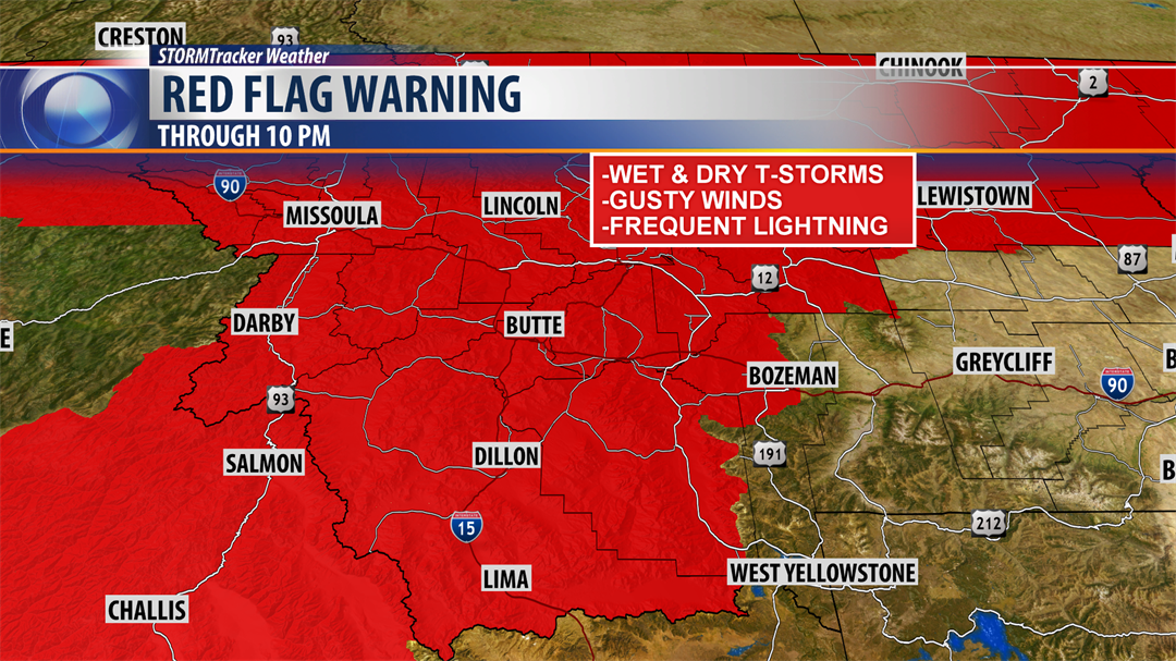
The National Weather Service continues a RED FLAG WARNING for most of Montana Thursday afternoon and evening. Another RED FLAG WARNING is up for Friday afternoon and evening.
Hot, dry and windy weather is increasing fire danger and to make matters worse thunderstorms will continue to develop Thursday afternoon and Friday afternoon.
Some storms could be wet and a few could be on the drier side. Regardless, during critical fire weather events please use good judgment and be extremely careful with working and playing outdoors.
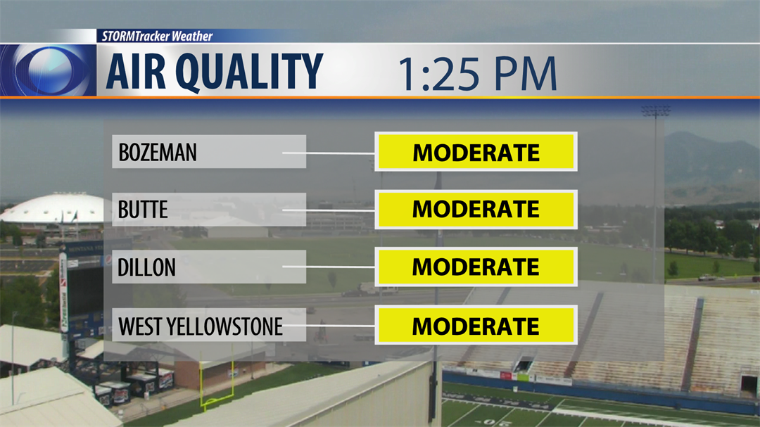
Air quality ratings continue to hold in the "moderate" range for SW Montana again Thursday. Helena’s air quality rating did get up to "unhealthy for sensitive groups" Thursday afternoon.
Check the current air quality rating: CLICK HERE
City by City Forecast:
BOZEMAN: LOW: 53°; HIGH FRIDAY: 84°. Watch for a few afternoon to early evening thunderstorms Bozeman. Some storms could be on the stronger side with a very low risk for severe thunderstorms Thursday afternoon. Biggest concern will damaging wind gusts over 50 mph.
BUTTE: LOW: 46°; HIGH FRIDAY: 81°. Most thunderstorms should by-pass Butte this afternoon and evening but to be safe watch for a pop thunderstorm if you have outdoor plans.
DILLON: LOW: 49°; HIGH FRIDAY: 84°. Thunderstorms are likely to develop over Beaverhead county this afternoon and evening and there is a low risk that a few storms could be very strong to severe with damaging outflow winds.
WEST YELLOWSTONE: LOW: 41°; HIGH FRIDAY: 77°. Scattered thunderstorms are likely over central and southern Gallatin county Thursday afternoon and a few storms could be strong to severe with damaging outflow wind gusts over 50 mph.
NEXT WEATHER MAKER:
This week a strong SW flow aloft has produced hot and mostly dry weather with abundant wildfire smoke lifting into Montana from large out of control fires in northern California. This pattern should be breaking down as a cold front passes through the state into Friday and an upper level Low develops over the region this weekend producing cooler temperatures. A north to NW flow is likely this weekend and we are hopeful this will bring improving air quality for several days.
