The atmosphere is very unstable for the next 48 hours.
A pacific cold front will trigger thunderstorms Wednesday afternoon and a new upper level Low will bring more thunderstorms to the region on Thursday.
Storm Prediction Center has a slight risk up for our region Wednesday afternoon for a few severe thunderstorms. Greatest concern will be wind gusts over 60 mph and there could be some localized large damaging hail.
Other issues that could develop is very heavy rainfall in a short amount of time which in turn could produce localized flash flooding issues. Slow moving thunderstorms Thursday are possible and if they develop could send smaller streams and creeks out of their banks especially near Anaconda and Deer Lodge.
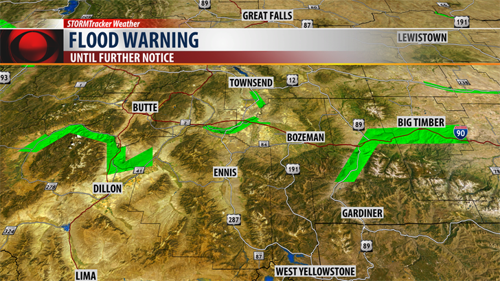
The National Weather Service has issued a FLOOD WATCH for the Butte/Blackfoot region (west of the divide from Butte to Avon to Ovando) for Thursday afternoon through Friday morning.
Warm Springs Creek in Anaconda and Cottonwood Creek in Deer Lodge are both running very high and if heavy rain hits these areas both smaller creeks could jump out of their banks and produce localized flooding, water over roadways and possibly washing out some dirt roads.
Keep checking the KBZK STORMTracker Weather Mobile app and be sure to adjust your radar tab, turn on the severe thunderstorm under the "Alert" section, turn on Storm Tracks and Lightning under "Overlays" and most importantly be sure to turn on Station Alerts, under the "Settings" tab.
The above on demand STORMTracker video forecast with Chief Meteorologist Mike Heard will walk you through the forecast hour by hour so you can see the timing, location and intensity of possible thunderstorms Wednesday afternoon and Thursday afternoon.
City by City Forecast:
BOZEMAN: LOW: 48°; HIGH THURSDAY: 71°. Thunderstorms are likely Wednesday afternoon into early Wednesday evening. There could be a few strong and maybe a few severe thunderstorms. Some storms could produce damaging outflow wind gusts greater than 60 mph. Some storms could produce heavy rain, frequent and deadly lightning and small hail. This pattern will likely re-develop again Thursday afternoon and evening.
BUTTE: LOW: 44°; HIGH THURSDAY: 68°. Scattered showers and a few strong thunderstorms are likely for Butte Wednesday afternoon and evening. There is slight risk for an isolated severe thunderstorm with damaging wind and hail. Storms will re-develop again Thursday afternoon and the biggest concern will be very heavy rainfall with slower moving thunderstorms Thursday into Friday which could lead to localized flooding especially along smaller streams.
DILLON: LOW: 44°; HIGH THURSDAY: 67°. Dillon and Beaverhead county watch for strong thunderstorms Wednesday and Thursday. Wednesday afternoon and evening some storms will be strong to severe with damaging outflow winds greater than 60 mph and there is low risk for large damaging hail. More storms are likely Thursday afternoon and evening and very heavy rain is possible around slower moving storms.
WEST YELLOWSTONE: LOW: 37°; HIGH THURSDAY: 62°. Thunderstorms moved into West Yellowstone Wednesday morning and more off and on storms are likely Wednesday afternoon and early evening. There is a chance for a few severe thunderstorms to hit this area and watch for damaging winds greater than 60 mph. Severe weather could hit this area again Thursday afternoon.
NEXT WEATHER MAKER:
Strong to severe thunderstorms will be impacting SW Montana Wednesday afternoon and again Thursday afternoon as a pair of storms hit the region. Severe weather threat is likely to be more widespread in SW Montana Wednesday afternoon but will move farther east from Gallatin County eastward Thursday afternoon.
The above on demand STORMTracker video forecast will walk you through the forecast hour by hour.
SUPPORTING GRAPHICS