


BOZEMAN – A cold and snowy pattern continued today for most of southern Montana. The upper-level trough is slowly moving eastward.
Most of the moderate to heavy snow bands are diminishing over SW Montana Tuesday afternoon with just some scattered snow showers and light snow accumulations through early evening.
Travel conditions will remain wintry especially east of the divide with the worst travel conditions from Bozeman Pass eastward to Billings down into northern Wyoming, and Bozeman southward over Norris Hill and Raynolds Pass over to West Yellowstone.
Skies should clear overnight allowing temperatures to fall well below normal down into the teens to low 20s for the lower valleys.
The next disturbance could produce a few snow showers again Wednesday evening into Thursday with the best chance for accumulations to be around Big Sky to West Yellowstone and over most local mountain ranges. Valleys could see some periods of light snow as well with little to no accumulations likely for Bozeman and Butte.
The National Weather Service has extended a WINTER STORM WARNING for the Livingston to Big Timber areas as well as the backcountry near Cooke City. The Absaroka/Beartooth mountains and Crazy mountains could see another 5”-10” of snow through Wednesday evening.
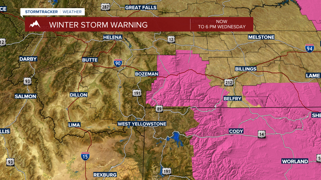
The National Weather Service has extended a WINTER WEATHER ADVISORY for most SE Montana from Billings to Miles City. Another 2”-8” of heavy wet snow is possible. Poweroutages are also possible and travel conditions will be hazardous at times.

