BOZEMAN – Another round of widespread snow will impact Montana beginning Wednesday night through Friday night.
A new Pacific storm is currently just off the Pacific NW coast and will push through the Northern Rockies beginning Wednesday afternoon along the MT/ID state line with significant travel impacts for Lookout Pass to Spokane, WA.
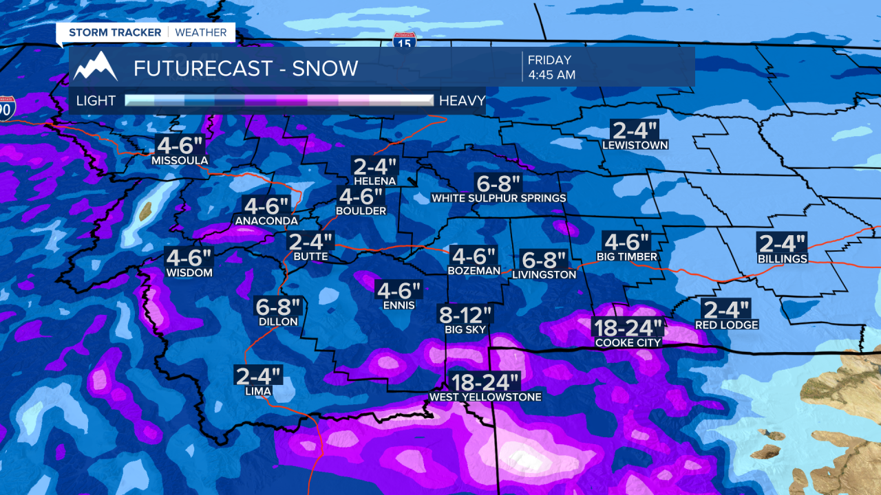
This storm will slowly track into SW Montana Wednesday night with mountain snow likely through Thursday morning and light snow for most valleys. Most forecast models show a stronger surge of moisture arrives Thursday afternoon through Friday afternoon. During this time moderate valley snow is possible with periods of heavy mountain snow. One area of concern is around West Yellowstone and Island Park, ID. Mountain snow totals could be around 1 to 2 feet.
Gusty surface winds are possible with the next cold front and more challenging travel conditions with areas of blowing snow possible with this next storm system.
Look for additional winter weather highlights to be issued anytime for valleys and mountains and mountain passes.
The National Weather Service issued a WINTER STORM WARNING for west central and NW Montana including I-90 Missoula to Lookout Pass. Snow accumulations of 8"-12" is likely from 11 pm Tuesday to Midnight Thursday. This warning extends through Northern Idaho into Eastern Washington State and the Spokane, WA area.

The National Weather Service has issued a WINTER STORM WARNING for mountain ranges in Madison and Gallatin counties into the Centennial Range and Island Park, ID midnight Wednesday through 5 pm Friday. General snow accumulations will be 5"-10" with the heaviest snow around West Yellowstone and Island Park, ID with 12"-24" possible. Wind gusts to 45 mph are also possible. Look for blowing and drifting snow at times especially as a cold front passes through Thursday evening.

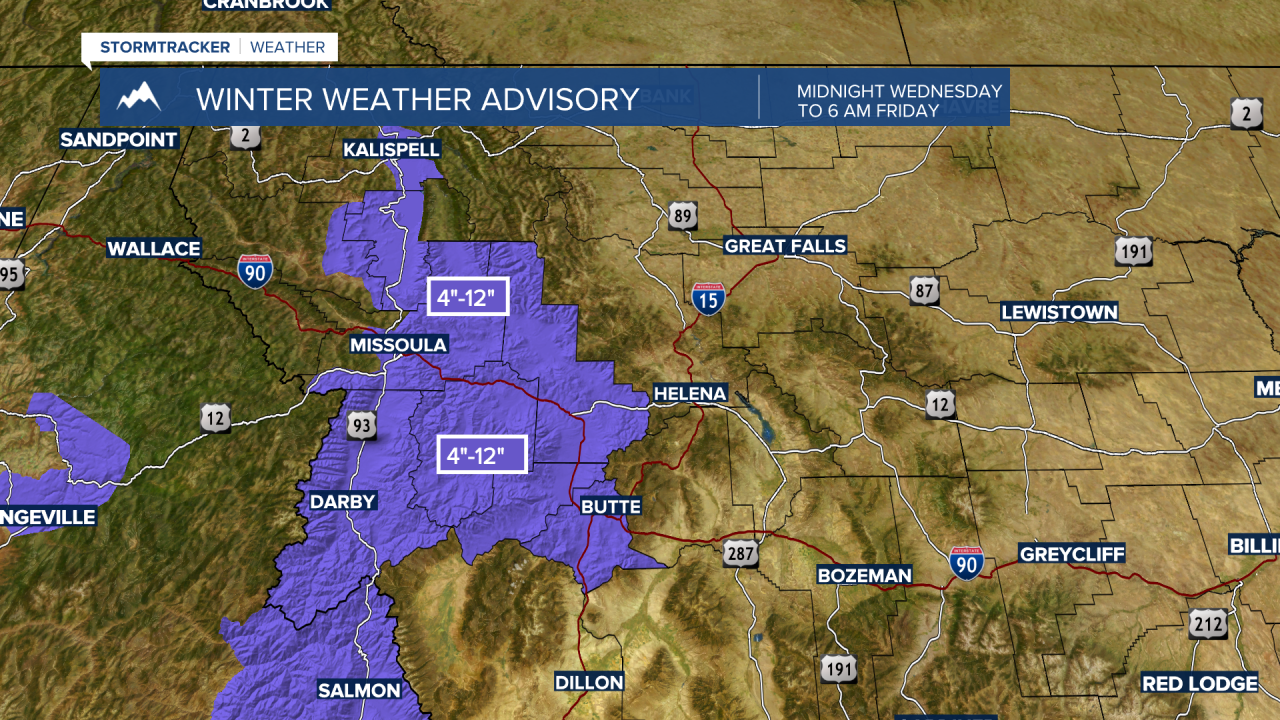
The National Weather Service has issued a WINTER WEATHER ADVISORY for the Butte/Blackfoot region from Midnight Wednesday through 6 am Friday. 4"-12" of snow is possible and includes the Butte and Homestake Pass areas, Georgetown Lake, Anaconda, Philipsburg, Deer Lodge, MacDonald Pass.