


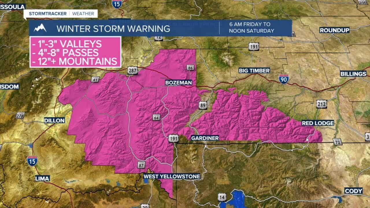
A Winter Storm Warning is in effect starting at 6 AM Friday through Noon Saturday for Gallatin and Madison counties. Periods of heavy snow should be expected. Low valleys should expect 1”-3” of wet snow with 3”-6” in higher valleys and passes. Mountains could pick up between 1’-2’ of moisture-laden snow.
Today's Forecast: Expect scattered rain showers for valleys with a mix of rain and snow possible. Mountains in southwest Montana will likely bring heavy and wet snow in the mountains. Highs today should stay in the 50s with a wind out of the northwest between 10-20 mph. Snow showers will pick up for the evening with snow developing over southern Gallatin and Madison counties overnight.
BOZEMAN: High: 57; Low: 33. Off and on rain showers should be expected by the afternoon. There is a slight possibility of picking up a brief rain/snow mix before rain and an occasional thunderstorm late in the afternoon. Look for light snow to develop overnight.
BUTTE: High: 50; Low: 29. Spotty showers are expected to develop late in the morning and into the afternoon. A mix of rain and snow is possible for at least a portion of the morning. Accumulation is expected to be light by early Friday morning.
DILLON: High: 54; Low: 31. Windy and mild with spotty showers possible through the afternoon and early evening.
WEST YELLOWSTONE: High: 51; Low: 26. Look for a mix of rain and snow for the afternoon with heavy wet snow expected to develop overnight. Accumulations through noon Friday could approach 4”-6”.


