


BOZEMAN – A slow moving High-pressure ridge will continue to produce a mild and dry weather pattern through the end of the week.
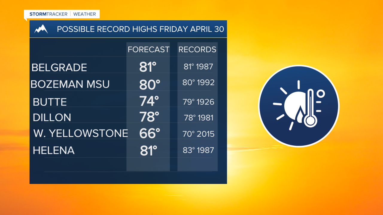
In fact, temperatures could reach record high levels by Friday and our first round of 80° temperatures are possible for several areas within SW Montana.
That type of heat will be possible due to a strong SW flow aloft, surface winds increasing Friday afternoon and very low relative humidity. That combination could lead to a higher fire danger rating for SW Montana lower valleys thus Friday avoid spring burning projects.
By the weekend, a cold front will pass through the state Saturday into Sunday. This will produce scattered showers, a few isolated thunderstorms, and possibly higher mountain snow. This will also produce cooler temperatures especially by Sunday into Monday.
