


BOZEMAN – Pattern change is just beginning to move into far western Montana Tuesday afternoon with a slow-moving cold front and very slow to almost stalled upper-level Low Wednesday night through Saturday.
This means increasing rain or snow will impact most of western and SW Montana. We are below normal on month to date, year to date, and water year to date precipitation for most reporting stations in our area. Drought conditions continue to worsen weekly because of the abnormally dry weather.
This pattern change is a welcome site and forecast models show most of us could see a half an inch to 2 inches of moisture in the next 3 to 5 days. This will not be enough to wipe our moisture deficit, but it should help ease the dry conditions for a while.

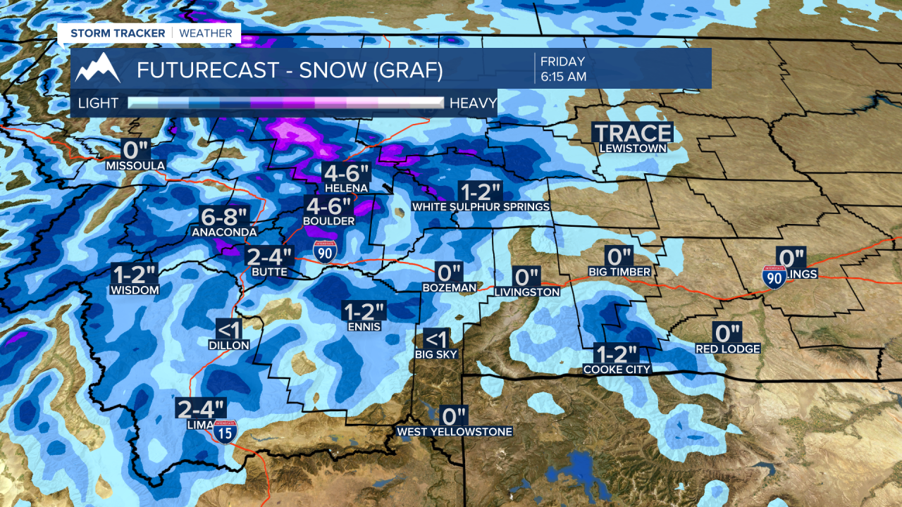
Snow is possible at pass level and higher and slushy accumulations are possible which will bring slow-go travel conditions beginning Thursday morning for most passes in SW Montana. Valleys could see a rain/snow mix and at times all snow in the early morning hours, however, road surfaces should be warm enough to melt most of the snow, but grassy areas could see some minor accumulations Thursday through Saturday morning.
Forecast lows will fall down to or below freezing by Saturday morning and that will put us very close to record low levels. If you were bold enough to plan flowers already beware that frost is likely this weekend.
