


BOZEMAN – The month of June was a huge disappointment for precipitation across Montana. In fact, the last 60 days fell well short on precipitation. May and June on average is the wettest time of the year and we should have 2”-6” of moisture for that 60-day period.
This past June for SW Montana ranked in the top 5 driest and hottest for SW Montana.
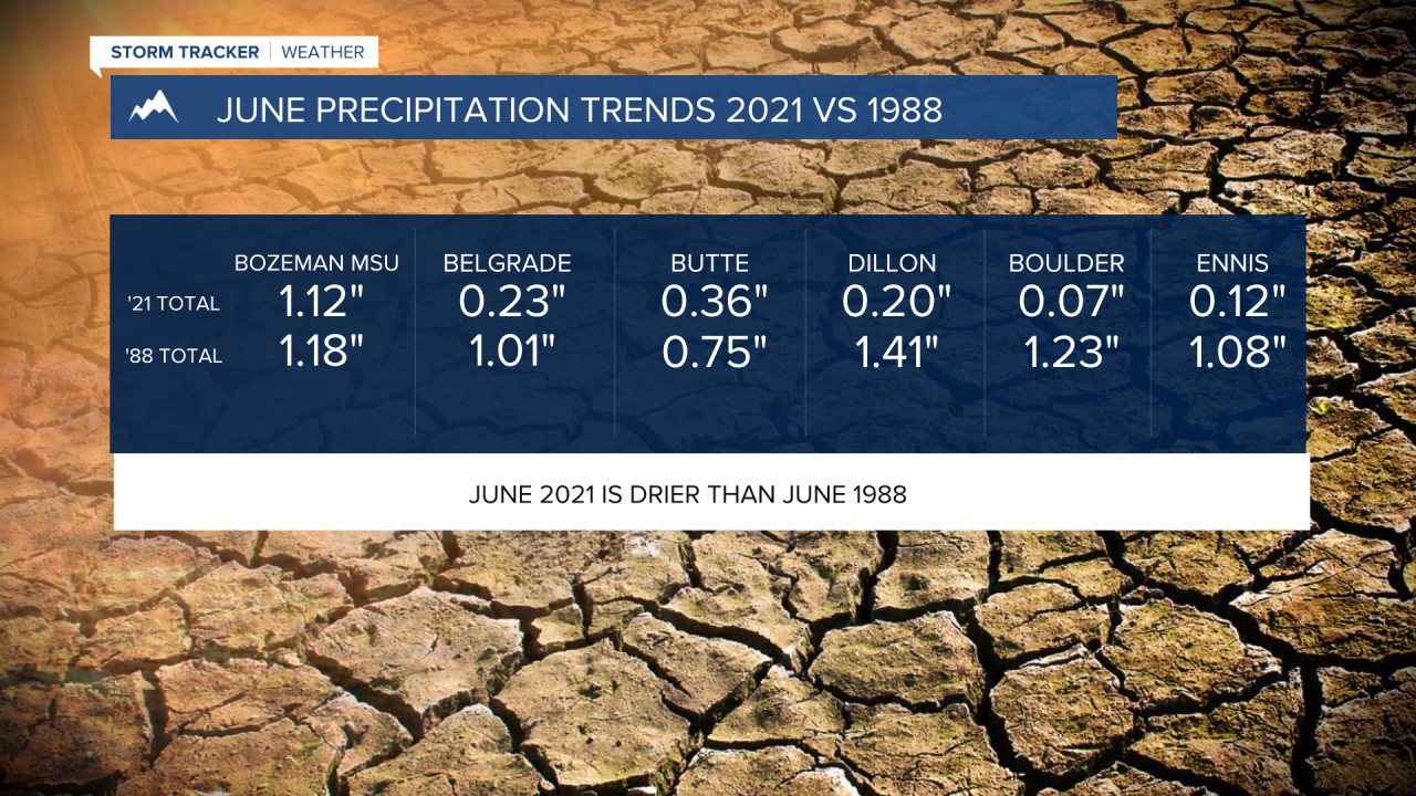
Tracking total precipitation trends Bozeman MSU reported the highest rainfall for June with a little over 1 inch. Unfortunately, this was only around 34% of average. For Bozeman MSU they reported their 12th driest June on record.
The rest of SW Montana fell into the top 2 driest June’s on record. Bozeman Yellowstone Airport in Belgrade only picked up just under a quarter of an inch for June. This is the #1 driest June on record. Butte reported 0.36” of an inch and that is ranked as the 2nd driest on record. Dillon, West Yellowstone, and Ennis also reported their #1 driest total precipitation amounts of June.

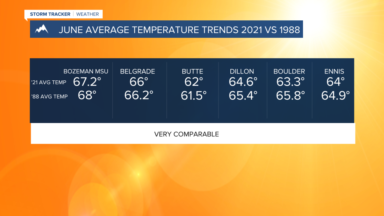
Temperature trends were also alarming for SW Montana. Average temperatures for the month across all reporting stations in SW Montana fell into the top 5 hottest on record. Departures from normal were extremely high and varied from around 5° to almost 9° above normal.
Bozeman MSU and Belgrade (Bozeman Yellowstone Airport) average temperature ranked 2nd hottest on record, Dillon had their 3rd hottest on record, and Butte, West Yellowstone, Ennis checked in with their 4th hottest on record.

In researching this data, I found it very interesting and scary that June of 2021 was extremely comparable to June of 1988 both with average temperature and total precipitation. In fact, June of 2021 was drier than that of June 1988.
Most of us remember the summer of 1988 as one of the most historic and destructive fire season across Montana and Yellowstone National Park.
The updated Montana Drought Monitor also has seen a sharp increase in Moderate, Severe, and Extreme ratings across the state. There has been a 50% increase in all three ratings in just the last 2 weeks according to the National Weather Service.
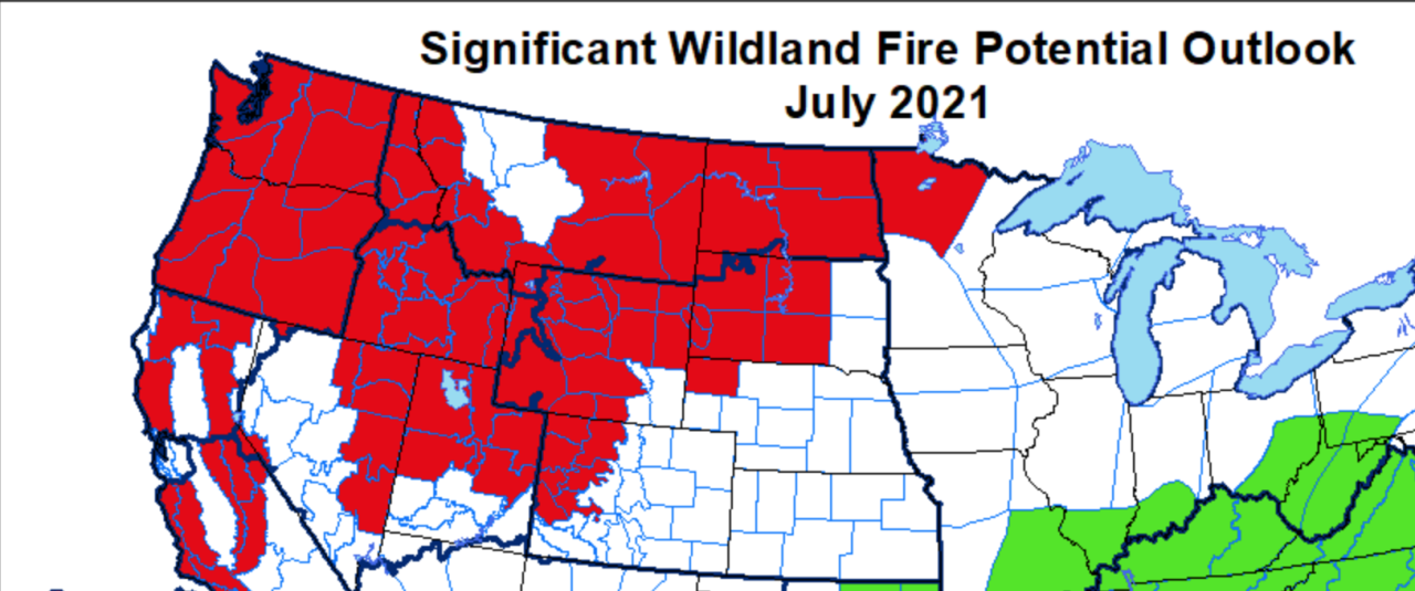
The Norther Rockies Coordination Center updated their monthly fire outlook on July 1st. The new forecast shows significant wildland fire potential for western, southern and eastern Montana for the month of July.
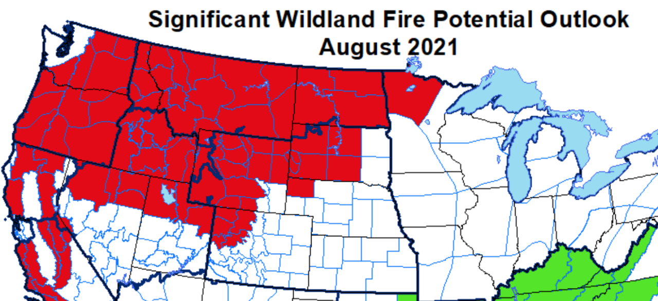
The entire state is likely to see significant wildland fire potential for the month of August.
Unfortunately, long range forecast for the next 60 to 90 days (July - September) from the Climate Prediction Center has more of the same for Montana. Above normal temperatures and below normal precipitation.
The last good widespread wet weather month for SW Montana was roughly back in June of 2020. Abnormally dry conditions have been building over SW Montana since last summer and that has led us to this moment with extremely dry conditions. Looking ahead we are primed for a possible historic fire season July through September.
