


Today's Forecast: Highs are expected to climb to the 70s and 80s for today. With warmer temperatures and a southeast flow across the region we are likely to see some spotty thunderstorms develop after 3 pm.Severe weather threat is minimal today with those showers widely scattered across the area through the early evening.
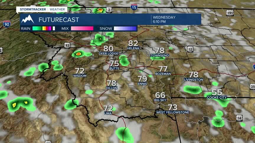
BOZEMAN: High: 78; Low: 49. Look for partly cloudy skies for your Wednesday with a few isolated thunderstorms developing after 3 PM through the early evening.Winds are expected to stay out of the southeast between 5-10 mph.
BUTTE: High: 76; Low: 46. Foggy conditions for the morning will give way to mostly sunny skies through the afternoon.A few area t-storms are possible for the afternoon and early evening. Winds will stay out of the southeast between 5-10 mph.
DILLON: High: 78; Low: 50. Expect partly cloudy skies for the morning with temperatures climb quickly into the 70s.A few showers are likely this afternoon and evening.
WEST YELLOWSTONE: High: 73; Low: 39. Partly cloudy to mostly sunny skies are expected with a slim chance for a stray afternoon shower.
COOLER AND WET FOR THE WEEKEND
The weekend will cool down considerably from the 70s and 80s down to the low and middle 50s.Showers are likely for both Saturday and Sunday.Saturday is expected to bring showers throughout the day into the evening.The system will begin to lift out of the area on Sunday though we will see showers linger.The latest model runs are a little iffy about the timing that the system moves out.With that said, the most reliable information points that there will be some showers in the morning and will clear toward the afternoon hours.We will continue to keep you updated as the latest data comes out.
