


BOZEMAN – A strong Pacific storm is passing through the Northern Rockies Tuesday afternoon and evening producing a wide variety of conditions.
This is a mature and large-scale storm with a warm front followed by a cold front and upper-level Low. This type of storm can produce a wide variety of conditions with unseasonably warm and windy weather with the warm front and higher mountain snow. The cold front will pass through tonight and begin to produce a cooling trend with a little valley rain or snow and more mountain snow.
The area of greatest concern continues to be along the MT/ID state-line from Monida Pass to West Yellowstone into Yellowstone National Park.
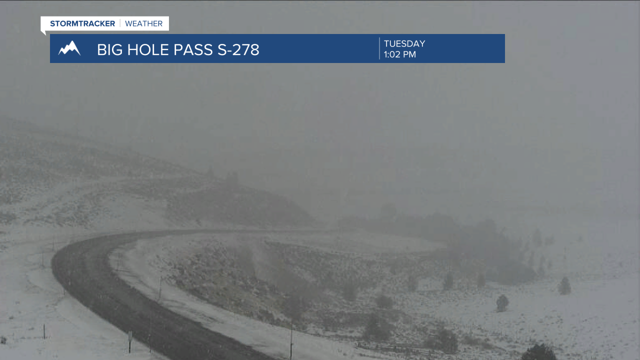
Areas of heavy snow and blowing snow will continue to impact travel conditions through this evening into Wednesday morning.
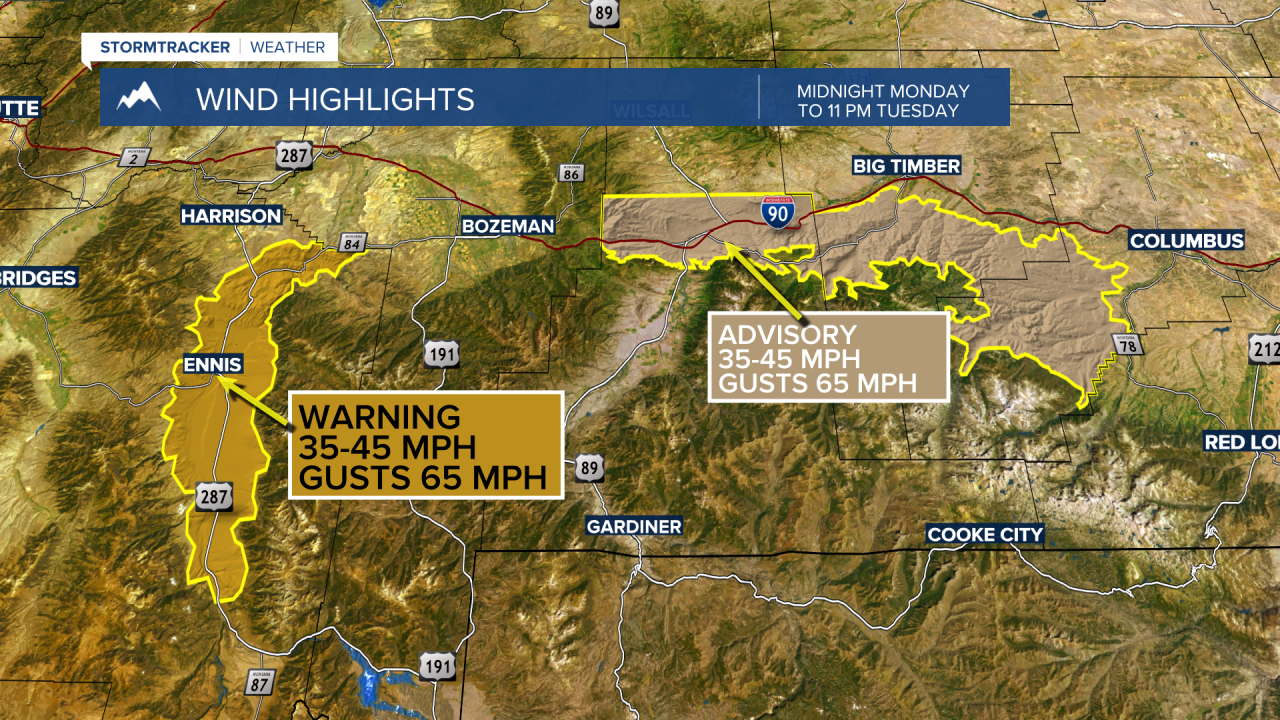
Strong surface wind gusts will also continue in the Ennis and Norris Hill region along with the Livingston area. Peak wind gusts over 60 mph are possible.
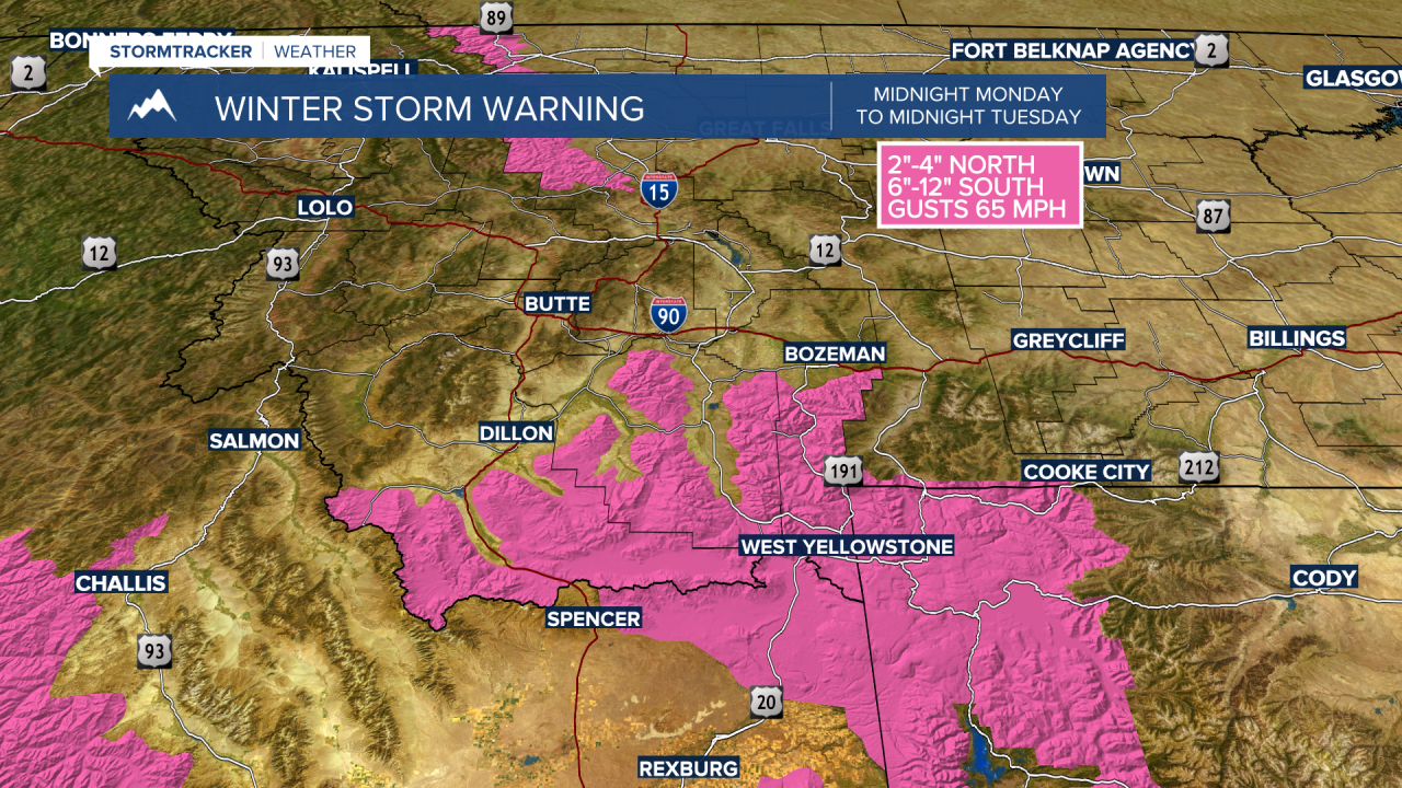
The National Weather Service continues a WINTER STORM WARNING for southern Beaverhead, Madison, and Gallatin Counties through midnight Tuesday. Island Park, ID and Yellowstone National Park are also under Winter Storm Warnings through this evening.
Another 3”-8” of snow is possible along with surface wind gusts to 60 mph.
The National Weather Service continues a HIGH WIND WARNING for the Ennis area and a WIND ADVISORY for the Livingston area through 11 pm Tuesday.
Peak wind gusts to 60+ mph is possible.
At the time of this report I-90 is closed due to powerful crosswind conditions in the Livingston area and traffic is detouring through Livingston.

