


BOZEMAN – Very little has changed in the last 24 hours with the current storm system sitting over SW Montana producing widespread areas of snow.
This storm system will bring several more inches of snow to most areas through early Monday morning and difficult to hazardous travel conditions. Most mountain passes are wet, slush covered, some are snow-packed and icy, a few have very low visibility with falling snow.
As the storm diminishes overnight all roadways will turn very icy for Monday’s morning commute. Plan and slow-go travel, extra travel time, and please use good defensive driving skills to avoid accidents and injuries.
The forecast is drier Monday through Tuesday, and this should help road conditions to slowly improve but more scattered snow is coming with a weak system Wednesday into Thursday.
Overall, temperatures will remain below normal this week into the upcoming weekend. We could see some lower 40s by Friday and Saturday.
The National Weather Service continues WINTER STORM WARNINGS (pink) and WINTER WEATHER ADVISORIES (blue) through midnight.
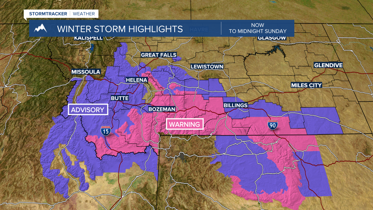
Lower valleys could see an additional 1”-6” and mountains and passes could see an additional 6”-12” by midnight.

