


BOZEMAN – A cool and wet weather pattern will develop Tuesday evening through Thursday morning across SW Montana.
A weak Canadian storm will be dropping southward producing cooler than normal temperatures and scattered mostly snow showers.
Accumulating snow is possible for lower valleys but most of the snow should melt as it hits the ground with grassy surfaces likely to see some of the falling snow stick.
The bigger issue will be over mountain passes. Snow or slush covered roads are possible for most mountain passes Tuesday night into Wednesday.
The National Weather Service has issued Winter Storm Warnings and Winter Weather Advisories tonight through Thursday morning. Mountains highlighted in pink in the graphic below could see over a foot of heavy wet snow.
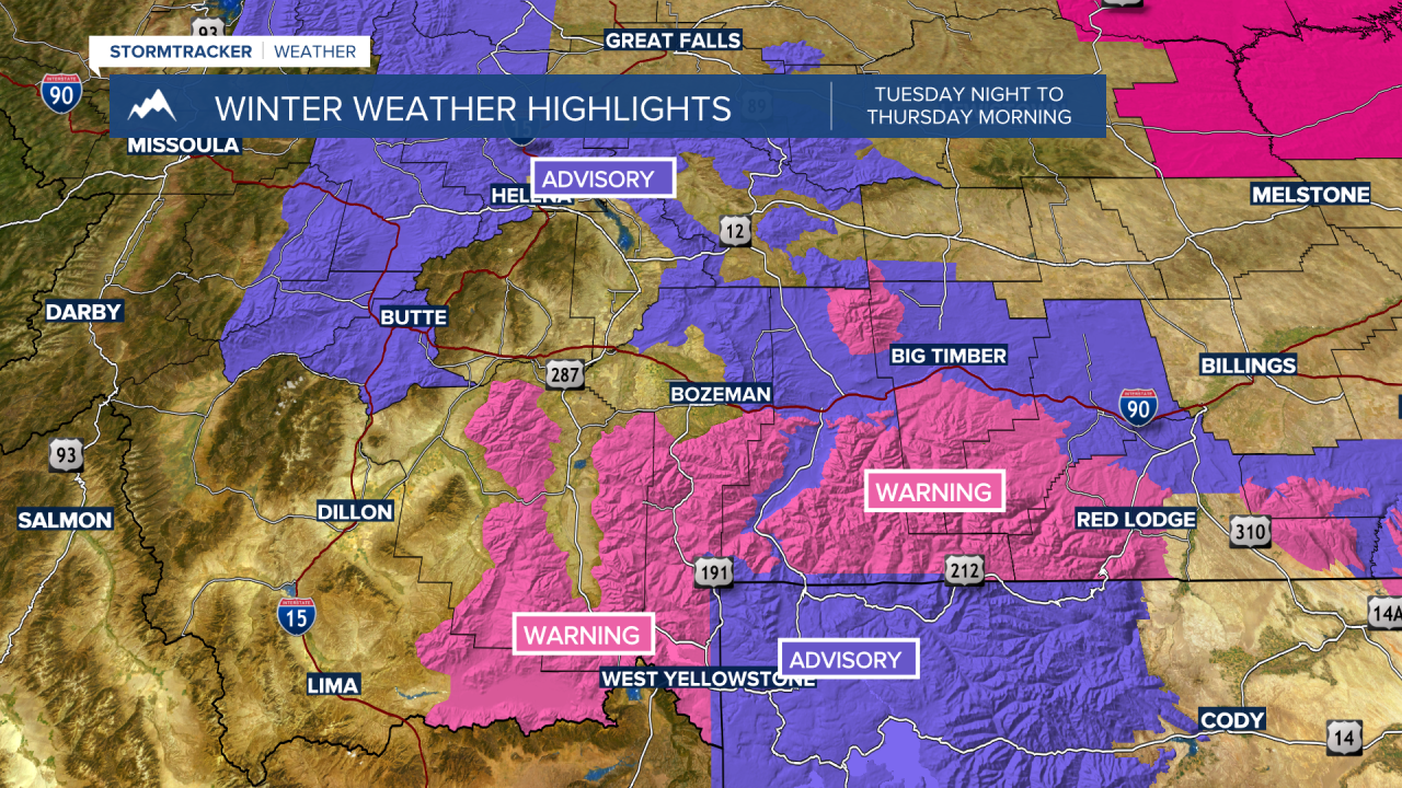
Winter Weather Advisories are up from Bozeman Pass eastward almost to Billings. I-90 could see wet or snow-covered road surfaces at times tonight into Wednesday.
This storm system will exit the region on Thursday and a slow warming trend could begin on Friday with a bigger rise in temperatures by early next week.
