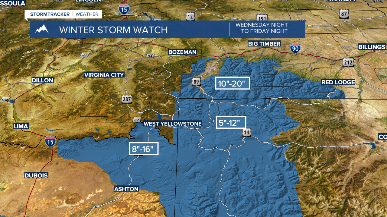
BOZEMAN – Traveling hazards are likely for the MT/ID state line Thursday into Friday. The highest probability for moderate to heavy snow will be across eastern Idaho, western Wyoming and up into the Absaroka-Beartooth range of Montana.
The National Weather Service continues a WINTER STORM WATCH Wednesday night through Friday night for possible moderate to heavy snow and blowing snow. This watch will be upgraded later today and look for updates tonight at 5:30 pm and 10 pm on KXLF and KBZK.
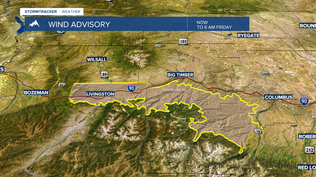
The National Weather Service also continues a WIND ADVISORY for the Livingston area through Friday morning with possible peak gusts over 60 mph. Powerful crosswinds will impact I-90 in the Livingston area.
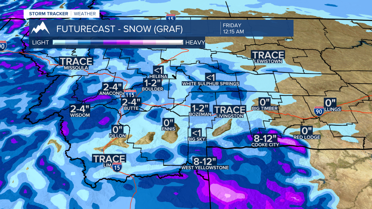
The rest of SW Montana will see continued mild temperatures again Thursday with gusty SW winds at times. However, look for increasing scattered snow showers Thursday afternoon into early Thursday evening for the Butte-Blackfoot region and after sunset for the Bozeman area.
Snow accumulations between Butte and Bozeman should be in the 1”-2” or 2”-4” range with just enough snow to produce icy road conditions especially by Friday morning.
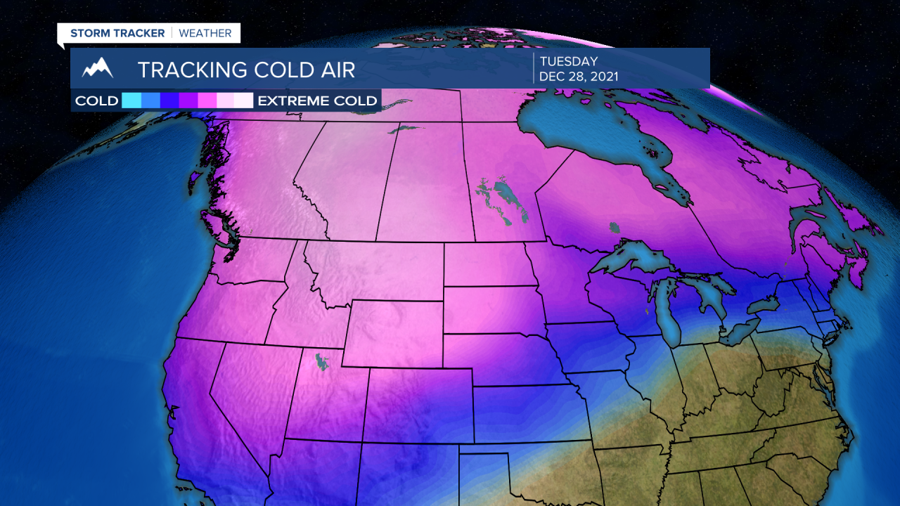
Arctic air will begin to move down into Montana Friday and will slowly deepen throughout the weekend with the coldest temperatures forecasted around Tuesday and Wednesday of next week.
Hi-line region of Montana will see below zero highs and lows with morning temperatures around –15 to –30 degrees below zero and highs in the single digits below zero. Temperatures will not be this cold across the southern half of the state but morning lows will likely fall below zero and highs around zero. Of course, wind chills will be the greatest hazard and possibly falling down to dangerous levels early next week.