


BOZEMAN – A very complex weather pattern is underway across the western U.S. as a plume of subtropical moisture is pushing across California and lifting to the Northeast.
Much of central and northern Rockies will see difficult to hazardous travel conditions through Friday and possibly into the weekend. The other big weather factor will be an Arctic cold front digging into the Pacific NW and Montana this weekend with the coldest temperatures arriving next week.
There are numerous winter weather advisories and winter storm warnings to update you on.
The National Weather Service continues a WIND ADVISORY for the Livingston area through Friday morning with possible peak gusts to 60+ mph. This will create powerful crosswinds on I-90 in the Livingston area.
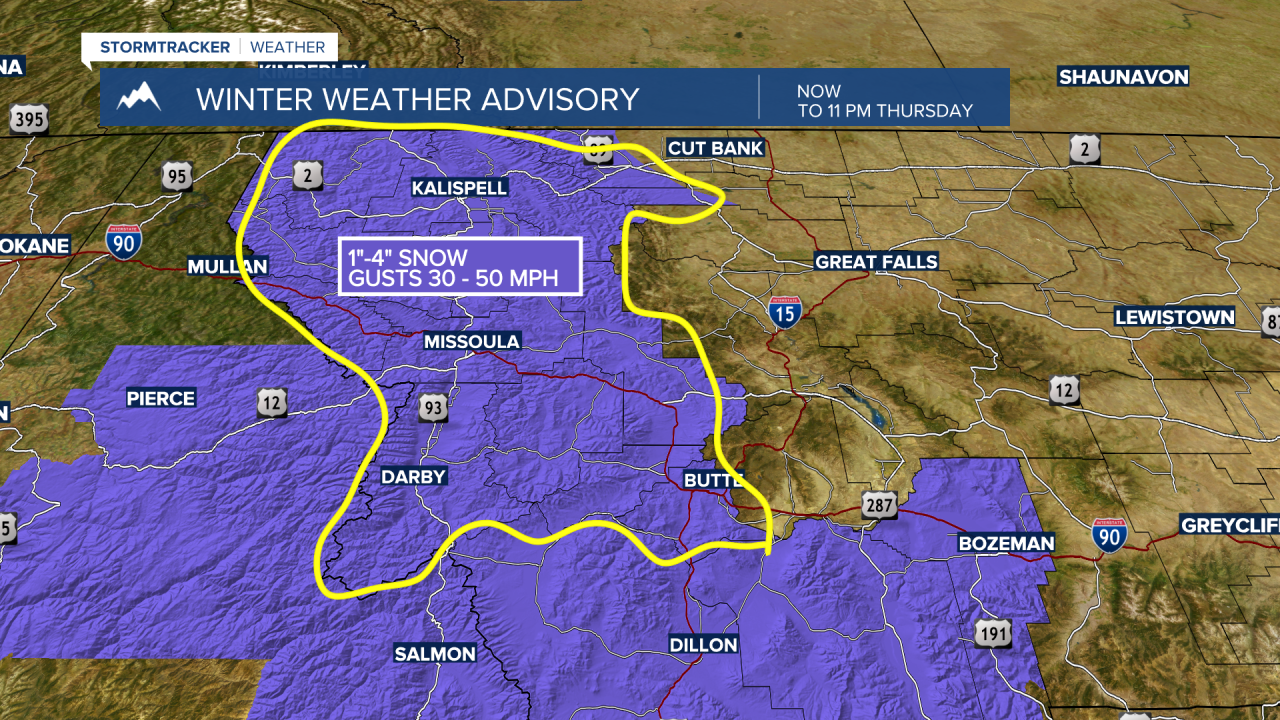
The National Weather issued a new WINTER WEATHER ADVISORY west of the divide for the Butte-Blackfoot region and the Missoula to Kalispell areas through 11 pm Thursday. Snow squalls will produce brief but intense snow showers and gusty winds. This could create difficult travel conditions with dry roads abruptly turning snow-covered and icy with blowing snow.
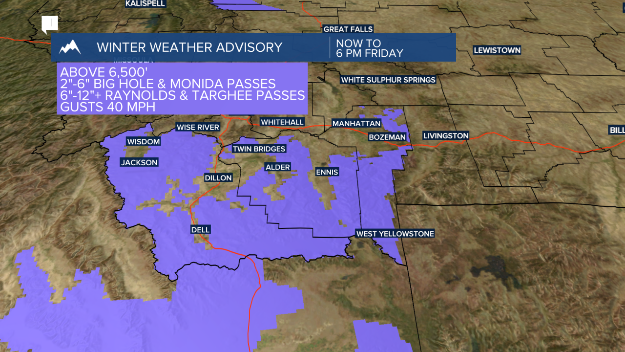
The National Weather Service continues a WINTER WEATHER ADVISORY for Beaverhead, Madison, and Gallatin counties above 6,500’ now through 6 pm Friday. Snow and blowing snow will create difficult to hazardous travel conditions especially for mountain passes.
The West Yellowstone area has seen steady snowfall all day Thursday and that should continue into Friday and it could continue through the weekend into early next week.

The National Weather Service continues WINTER STORM WARNINGS above 6,500’ through Friday evening for the Cooke City areas and backcountry areas, Yellowstone National Park, and eastern Idaho and Island Park areas.
1 to 2 FEET of snow is possible! Wind gusts 40 to 50 mph could also produce blowing snow and low visibility.

Snow accumulations should be on the lower side between Butte and Bozeman but just enough snow to produce some icy road conditions Friday into Saturday. Forecast models show the heaviest snow potential Thursday night through Sunday to be in the Big Sky, West Yellowstone, and Cooke City areas. Livingston to Big Timber could also see moderate snow accumulations by the end of the weekend.
Finally, an Arctic cold front will begin to dig into Montana this weekend first reaching the northern half the state by Saturday and slowly digging into southern Montana Sunday into Monday. This Arctic front will produce areas of light snow, some blowing snow through gap regions along the Continental Divide, and wind chill values colder than –20 below zero by early next week.
Forecast highs and lows are below zero to well below zero for northern and central counties of Montana beginning Sunday through Wednesday of next week. Southern Montana could see max temperatures reach the single digits above zero but forecast lows are –3 to –23 below zero by Tuesday next week.
Other side effects of the extreme cold next week will be ice jams and possible ice jam flooding along rivers, streams and creeks.
