


BOZEMAN – Isolated slow-moving thunderstorms are possible over SW Montana Thursday late afternoon through early evening.
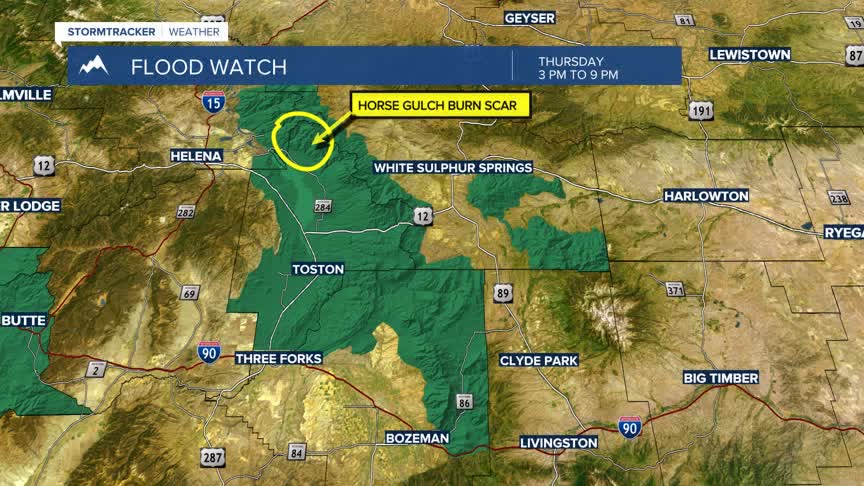
The National Weather Service has a FLOOD WATCH up for Silver Bow, Deer Lodge, and Granite Counties of SW Montana from 3 pm to 9 pm Thursday.
Excessive rainfall from slow-moving thunderstorms may result in flooding of creeks, streams, and other low-lying areas and flood prone locations including burn scars.
A FLASH FLOOD WATCH is also up for Northern Gallatin County, most of Broadwater County, and in a few areas of Meagher County Thursday afternoon through Thursday evening.
Again, slow-moving thunderstorms could produce flash flooding especially in the Horse Gulch Burn Scar NE of Canyon Ferry Reservoir.
This pattern will continue into Friday afternoon and possibly Saturday afternoon.
