


BOZEMAN – Active winter weather ahead for Montana and much of the central and northern Rockies through the weekend and into most of next week.
Travel hazards are likely in the form of more snow, gusty winds and blowing snow, Arctic air moving in Saturday night into Sunday morning producing wind chills down to or colder than –25 degrees below zero followed by morning low temperatures below zero next week.
The next round of snow and blowing snow with bitter wind chills arrives Saturday night into Sunday. Warm moist Pacific air will overrun cold dense Arctic air at the surface. As the Arctic air finds gaps in the mountains a sudden rush of sinking cold air will produce gusty winds and blowing snow. Early Sunday morning into Sunday afternoon snow, blowing snow, and bitter wind chills will impact SW Montana.
Monida Pass to West Yellowstone will have the highest probability of moderate to heavy snow at times through the weekend into Monday of next week. An additional 1”-4” is possible for Butte to Bozeman mostly Sunday morning into Sunday afternoon but West Yellowstone could see an additional 6”-18” of snow this weekend into early next week.

Arctic air begins to impact the hi-line of Montana by Saturday morning and slowly deepen over the entire state Sunday through Wednesday. The coldest forecast lows will be Tuesday and Wednesday morning for the entire state. Wind chill values for some areas could be colder than –30 degrees below zero even with a light 5 to 10 mph breeze.
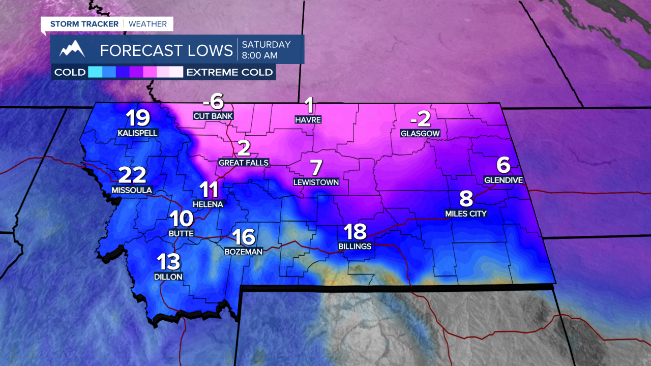


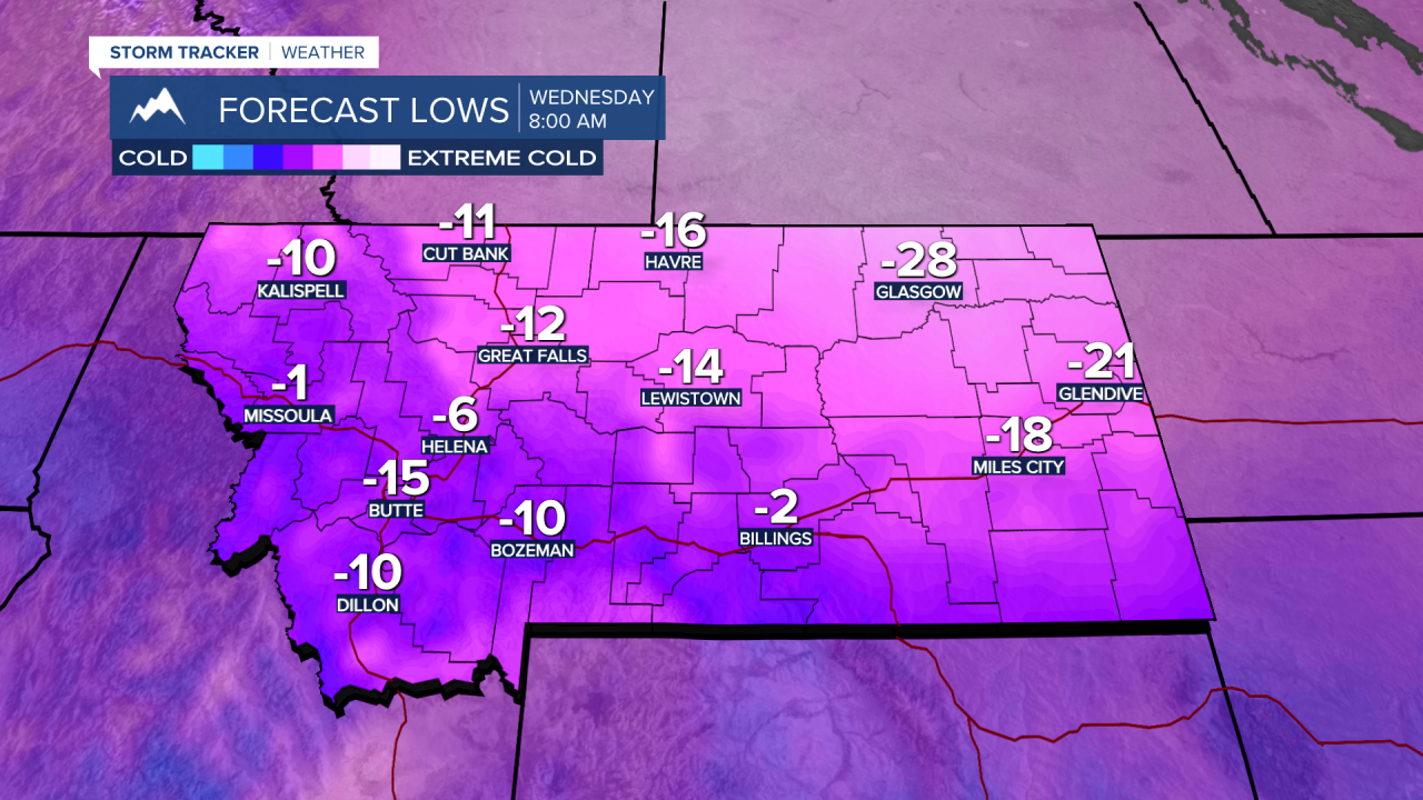
Plan accordingly for harsh winter weather with periods of snow, extremely cold temperatures, and at times dangerously cold wind chill values late weekend through most of next week.
