


BOZEMAN – Difficult to hazardous travel conditions will impact mountain passes on the MT/ID state line this weekend into early next week.
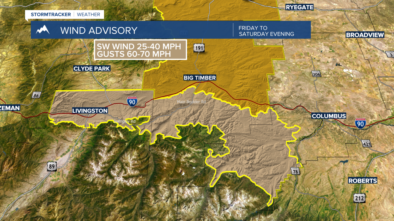
First, strong surface winds will impact all of SW Montana both sides of the divide Saturday into Sunday. The National Weather Service has a WIND AVISORY up in the Livingston area and a HIGH WIND WARNING up in the Big Timber area now through 6 pm Sunday. Peak wind gusts 60 to 70 mph are possible and these will be crosswinds on I-90 in the Livingston area.
There are numerous winter weather highlights up across ID, MT, WA.
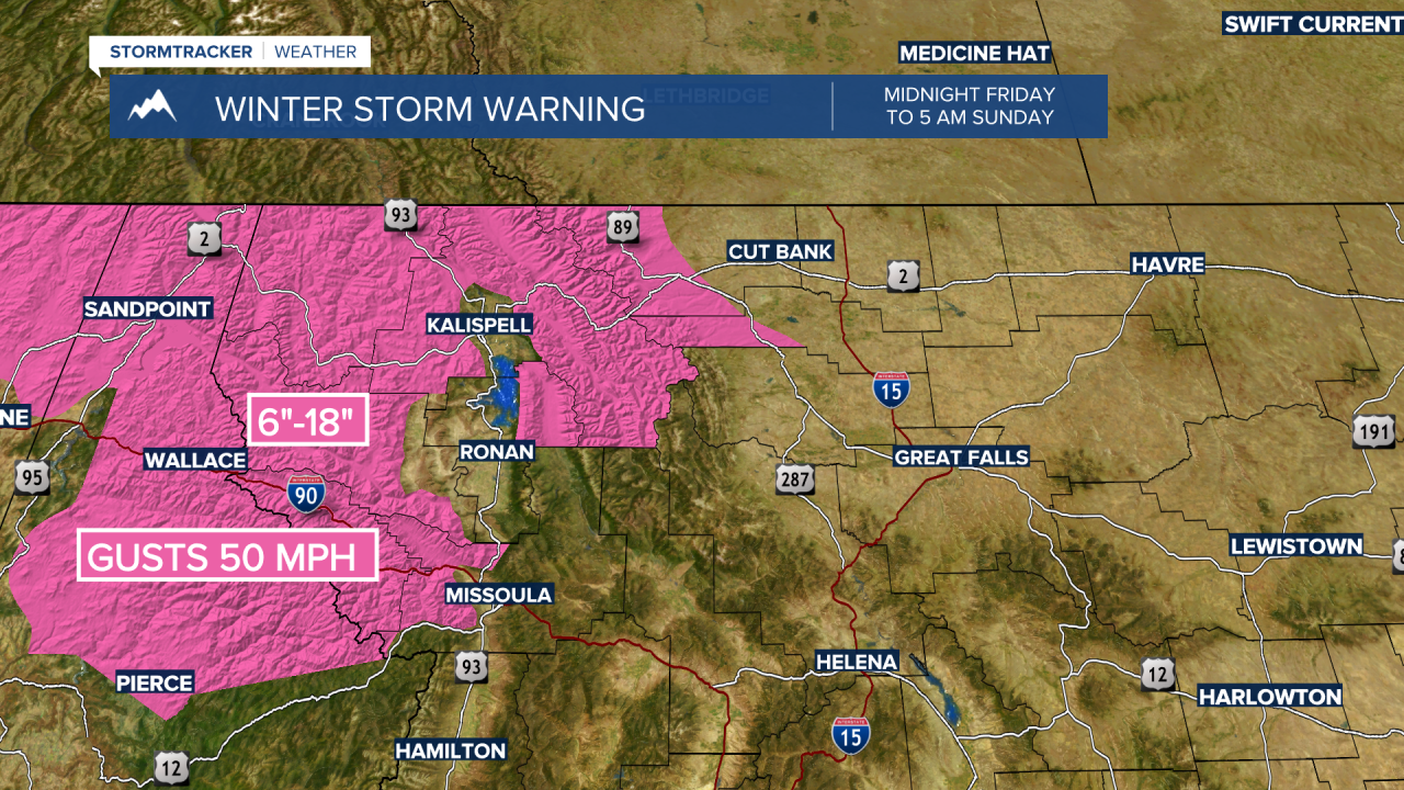
The National Weather Service issued a WINTER STORM WARNING for west central and NW Montana from Midnight Friday to 5 am Sunday. This includes I-90 Lookout Pass.
Snow accumulations of 6”-18” is likely above 3,500’ and 3”-6” of snow below 3,500’. Wind gusts at times could be as strong as 50 mph. This will create areas of blowing snow, reduced visibility causing difficult to impossible travel conditions.
_______________________________________________________________________________________________________________________________________________________________
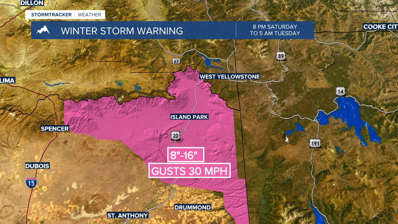
The National Weather Service issued a WINTER STORM WARNING for eastern Idaho including the Island Park area from 8 pm Saturday through 5 am Tuesday.
Periods of heavy snow with a total of 2 to 3 feet possible above 7,000’. 8”-16” of snow is likely below 7,000’ including US 20. Wind gusts up to 30 mph are possible. Additional snow is likely Tuesday into Wednesday.
Travel conditions will be very difficult to impossible. Areas of blowing snow and reduced visibility will be likely causing dangerous travel conditions.
________________________________________________________________________________________________________________________________________________________________
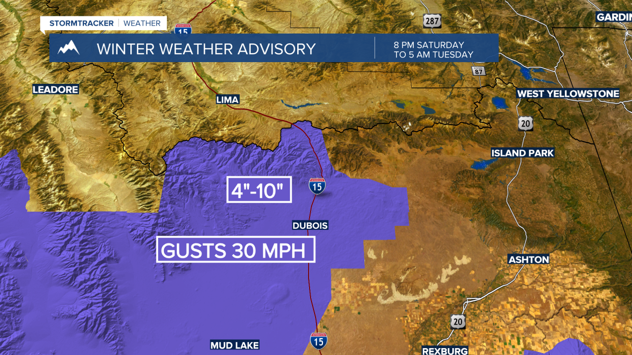
The National Weather Service issued a WINTER WEATHER ADVISORY for the Idaho side of Monida Pass on I-15 Saturday night through Tuesday morning.
4”-10” inches of snow is possible along localized wind gusts to 30 mph. Both will produce areas of blowing and drifting snow, reduced visibility along with snow-covered and icy road conditions.
____________________________________________________________________________________________________________________________________________________________________________
As of Friday evening there are no winter weather highlights up on the Montana side of Monida pass but plan on snow and wind with difficult travel on I-15 south of Dillon Saturday night through Tuesday with more snow and wind likely Tuesday into Wednesday.
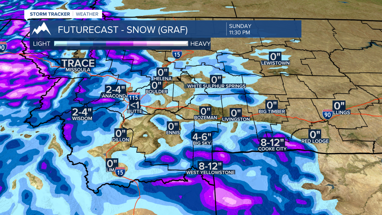
The West Yellowstone area could see 2”-4” of snow by Sunday morning and up to 8”-12” by Monday morning. Look for periods of heavy snow inside Yellowstone National Park this weekend into early next week as well.
Travel conditions could become hazardous for valleys and mountain passes across SW Montana with a cold front passing through the region Tuesday into Wednesday. There could be lower valley rain/snow mix Tuesday turning to all snow Tuesday night and extremely icy roads by Wednesday morning especially in the Bozeman area.
